What is recorded here
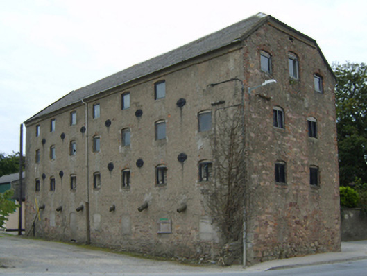
Detached seven-bay three-storey malt store with half-attic, extant 1840, on a rectangular plan with two-bay full-height side elevations. Reroofed, ----. Now disused. Replacement pitched and hipped gabled corrugated-asbestos roof on collared timber construction with pressed or rolled iron ridge, moss-covered concrete coping to gables, and cast-iron rainwater goods on rendered eaves retaining cast-iron downpipes. Part creeper- or ivy-covered fine roughcast coursed rubble "Old Red Sandstone" walls with concealed red brick flush quoins to corners. Square-headed window openings in camber-headed recesses between cast-iron "Pattress" tie plates with concealed red brick block-and-start surrounds framing rendered concrete block infill (ground floor) or remains of timber boarded fittings (upper floors). Set in unkempt grounds on a corner site.
A malt store representing an important component of the early nineteenth-century industrial heritage of Castlebridge with the architectural value of the composition, one of the 'very extensive stores and malt houses belonging to Mr. Patrick Breen [1771-1858]…capable of containing about 40,000 barrels of corn' (Lewis 1837 I, 291), confirmed by such attributes as the rectilinear plan form; the construction in a ruby-coloured "Old Red Sandstone" offset by red brick dressings producing a pleasing two-tone palette; and the uniform or near-uniform proportions of the openings on each floor.
From the Buildings of Ireland (National Inventory of Architectural Heritage) record 15614019
This does not grant access. Most recorded buildings are privately owned; view them only from public ground unless the owner allows entry.
Places near here
Photo credits
- National Inventory of Architectural Heritage
- David Hawgood, Wikimedia Commons · CC BY-SA 2.0
- Mike Searle, Wikimedia Commons · CC BY-SA 2.0
- Thommcg1980, Wikimedia Commons · CC BY-SA 4.0
- AFBorchert, Wikimedia Commons · CC BY-SA 4.0
- Danielclauzier, Wikimedia Commons · CC BY-SA 3.0
- Sarah777 at English Wikipedia, Wikimedia Commons · Public domain
- Chris, Wikimedia Commons · CC BY-SA 2.0
- Michal Osmenda, Wikimedia Commons · CC BY-SA 2.0
- Maker named on the Wikimedia Commons picture page · CC BY-SA 3.0
- Richard Webb, Geograph · CC BY-SA 2.0
IndicatedCastle, unclassified · 27 yd bridge51 ydArdcolm ChurchChurch/chapel · 51 ydArtramon CastleCastle, tower house · 1.3 miCommodore John Barry MemorialMemorial · 3.1 miSiege of WexfordSiege · 3.4 miSack of WexfordSiege · 3.4 miCurracloe BeachBeach / strand · 3.7 miRaven Point Nature ReserveForest · 3.7 miBallinesker BeachBeach / strand · 4.0 miDawn Redwood4.6 miForth MountainMountain / peak · 6.6 mi
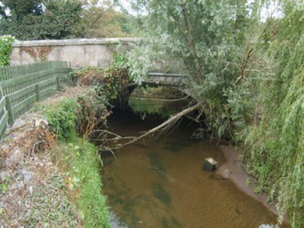 bridge51 yd
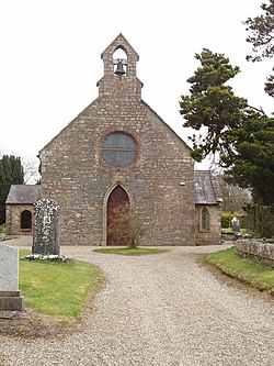 Ardcolm ChurchChurch/chapel · 51 yd
_-_geograph.org.uk_-_4570708.jpg/250px-Castles_of_Leinster,_Artramon,_Wexford_(2)_-_geograph.org.uk_-_4570708.jpg "Photo: Mike Searle, Wikimedia Commons · CC BY-SA 2.0") Artramon CastleCastle, tower house · 1.3 mi
Artramon CastleCastle, tower house · 1.3 mi Commodore John Barry MemorialMemorial · 3.1 mi
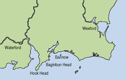 Siege of WexfordSiege · 3.4 mi
 Sack of WexfordSiege · 3.4 mi
 Curracloe BeachBeach / strand · 3.7 mi
 Raven Point Nature ReserveForest · 3.7 mi
 Ballinesker BeachBeach / strand · 4.0 mi
 Dawn Redwood4.6 mi
 Forth MountainMountain / peak · 6.6 mi
More historic places in County Wexford · All of County Wexford
What do you know about this place?