What is recorded here
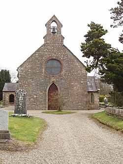
Situated on the S bank of a meandering NE-SW tidal river c. 60m from the stream. Lewis (1837, vol. 1, 45) records that the present Church of Ireland church was built in 1764 on the site of a castle that was on ground provided by the bishop. The name ‘Castlebridge’ would suggest that there was a castle here, but this and the Lewis statement are the only indications of it. The 1839 and 1925 eds of the OS 6-inch map record the site of a church (WX032-031001-) at the same location. There is no visible trace of an older church or castle at ground level within a raised rectangular graveyard (WX032-031002-), and the present church was probably built in the developing village of Castlebridge at a location that may have had a castle.
Situated on the S bank of a meandering NE-SW tidal river c. 60m from the stream. Lewis (1837, vol. 1, 45) records that the present Church of Ireland church was built in 1764 on the site of a castle that was on ground provided by the bishop. The name ‘Castlebridge’ would suggest that there was a castle here, but this and the Lewis statement are the only indications of it. The 1839 and 1925 eds of the OS 6-inch map…
From the National Monuments Service (Archaeological Survey of Ireland) record WX032-031003
This remains an important historical record, but the official description says the monument is no longer visible or has been destroyed. The monument record does not grant public access. Check the route and ask the landowner before entering private land.
- What survives
- No visible remains or recorded as destroyed
Places near here
Photo credits
- National Inventory of Architectural Heritage
- David Hawgood, Wikimedia Commons · CC BY-SA 2.0
- Mike Searle, Wikimedia Commons · CC BY-SA 2.0
- Thommcg1980, Wikimedia Commons · CC BY-SA 4.0
- AFBorchert, Wikimedia Commons · CC BY-SA 4.0
- Danielclauzier, Wikimedia Commons · CC BY-SA 3.0
- Sarah777 at English Wikipedia, Wikimedia Commons · Public domain
- Chris, Wikimedia Commons · CC BY-SA 2.0
- Michal Osmenda, Wikimedia Commons · CC BY-SA 2.0
- Maker named on the Wikimedia Commons picture page · CC BY-SA 3.0
- Richard Webb, Geograph · CC BY-SA 2.0
 malt house27 yd
 Ardcolm ChurchChurch/chapel · 27 ydPeace GardenMemorial · 66 yd
_-_geograph.org.uk_-_4570708.jpg/250px-Castles_of_Leinster,_Artramon,_Wexford_(2)_-_geograph.org.uk_-_4570708.jpg "Photo: Mike Searle, Wikimedia Commons · CC BY-SA 2.0") Artramon CastleCastle, tower house · 1.3 mi
Artramon CastleCastle, tower house · 1.3 mi Commodore John Barry MemorialMemorial · 3.1 mi
 Siege of WexfordSiege · 3.3 mi
 Sack of WexfordSiege · 3.3 mi
 Curracloe BeachBeach / strand · 3.7 mi
 Raven Point Nature ReserveForest · 3.7 mi
 Ballinesker BeachBeach / strand · 4.0 mi
 Dawn Redwood4.6 mi
 Forth MountainMountain / peak · 6.6 mi
More castles and forts in County Wexford · All of County Wexford
What do you know about this place?