What is recorded here
Large embanked enclosure shows on aerial photo (CUCAP BDU 8) with possible smaller circular area delimited by a fosse almost at the centre of the site. Possible entrance at the N. Not visible at ground level.
From the National Monuments Service (Archaeological Survey of Ireland) record OF026-027
The monument record does not grant public access. Check the route and ask the landowner before entering private land.
- What survives
- Recorded monument
Places near here
Photo credits
- National Inventory of Architectural Heritage
- Trenchspike, Wikimedia Commons · CC BY-SA 4.0
- Algirdas at Lithuanian Wikipedia, Wikimedia Commons · Public domain
Church (Site of) GraveyardChurch · 280 yd farm house800 ydSaint Mary's Catholic ChurchChurch/chapel · 914 ydEnclosure in KilcooneyEnclosure · 977 ydRaheen Castle in ruinsCastle, unclassified · 1320 ydRaheen Castle (site of)Archaeological place · 1367 ydThe Lord's WellSpring · 1.6 miGhaugher HillMountain / peak · 1.7 miFather BurbageMemorial · 2.4 miGeashill Glebe WalkVisitor information · 2.4 miFurzehill WoodWood · 2.9 miPedunculate Oak4.7 mi
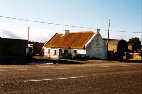 farm house800 yd
 Saint Mary's Catholic ChurchChurch/chapel · 914 ydEnclosure in KilcooneyEnclosure · 977 ydRaheen Castle in ruinsCastle, unclassified · 1320 ydRaheen Castle (site of)Archaeological place · 1367 ydThe Lord's WellSpring · 1.6 miGhaugher HillMountain / peak · 1.7 mi
 Father BurbageMemorial · 2.4 miGeashill Glebe WalkVisitor information · 2.4 miFurzehill WoodWood · 2.9 mi
 Pedunculate Oak4.7 mi
More archaeology and monuments in County Offaly · All of County Offaly
What do you know about this place?