What is recorded here
In undulating pasture on S-facing slope with good views in all directions, 100m SW of cairn (LI014-072----). Not depicted on the OS maps. Identified as a conjoined circular enclosure from Bruff Survey aerial photograph (AP 4/3742). No surface remains of the monument visible when inspected in 2005. No surface remains visible on Google Earth orthoimage taken 19/11/2019.
From the National Monuments Service (Archaeological Survey of Ireland) record LI014-119
The monument record does not grant public access. Check the route and ask the landowner before entering private land.
- What survives
- Recorded monument
Places near here
Photo credits
- Ronnie Nijboer, Wikimedia Commons · CC0
- National Inventory of Architectural Heritage
- Mike Searle, Wikimedia Commons · CC BY-SA 2.0
- Garry Dickinson, Geograph · CC BY-SA 2.0
Site of Killanoher Burial GroundChildren's burial ground · 479 ydSt Lawrence's WellSpring · 864 ydEnclosure in Inch St. Lawrence NorthEnclosure · 954 yd Wych Elm1124 ydHighpark HouseCountry house · 1.2 miCatholic Church of the Immaculate Heart of MaryChurch/chapel · 1.3 miCaherconlish ChurchChurch/chapel, mausoleum · 1.3 miRockstown Castle (in ruins)Castle, tower house · 3.0 miSkool HillMountain / peak · 3.7 miBanoge's WellSpring · 3.7 miCastleCastle, motte and bailey · 3.9 miGraveyard in AbingtonGraveyard · 4.3 mi
 Wych Elm1124 yd
 Highpark HouseCountry house · 1.2 mi
 Catholic Church of the Immaculate Heart of MaryChurch/chapel · 1.3 mi
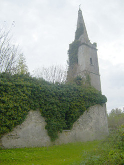 Caherconlish ChurchChurch/chapel, mausoleum · 1.3 mi
 Rockstown Castle (in ruins)Castle, tower house · 3.0 miSkool HillMountain / peak · 3.7 miBanoge's WellSpring · 3.7 mi
 CastleCastle, motte and bailey · 3.9 miGraveyard in AbingtonGraveyard · 4.3 mi
More archaeology and monuments in County Limerick · All of County Limerick
What do you know about this place?