What is recorded here
In gently undulating pasture. Not depicted on OS historic mapping. Identified by Aegis in 2006 during test trenching (Ministerial Direction Number A026, NRA Reg. E3420) prior to the construction of the Southern Limerick Ring-Road and excavated in 2007 by Patricia Long as part of Sallymount 1 (Long 2009, 4). This revealed extensive multi‐period activity spanning the Bronze Age through to the early medieval period (ibid, 3). Bronze Age activity was represented by a two pits, one of which contained a Late Bronze Age domestic vessel. This activity, along with several possibly associated pits and postholes, was centred towards the middle of the site. A subcircular-shaped Iron Age enclosure was identified in the NE part of the site. This comprised three segmented ditches separated by two causeways. Further Iron Age activity was identified to the S and SW, with the identification of a ninepost structure (Structure 1) associated with cereal processing and a linear ditch containing deliberate dumps of metalworking waste (ibid). The interior of the sub‐circular enclosure produced evidence of early medieval domestic activity in the form of a hearth, a four‐post structure (Structure 2) and numerous pits, post and stakeholes, some of which formed alignments (ibid). An early medieval curvilinear ditch truncated the S side of the enclosure and extended to SW, toward the Iron Age ditch containing the metalworking waste; an additional linear ditch truncated the western side of this earlier linear, subsequently forming a sub‐rectangular enclosure to W of the circular one. This enclosed numerous pits, post and stakeholes, as well as the Bronze Age activity described above. Two definite structures were identified immediately to S of this sub‐rectangular enclosure. The most westerly of these (Structure 3) was rectangular in plan and contained acentral smithing hearth associated with metalworking activities. To the east of this was a series of posthole rows (Structure 4) which surrounded two ‘dumb‐bell’‐shaped corn‐drying kilns. A large concentration of postholes and pit features were also identified in the SW area of the site. Although no definite arrangements could be identified it is believed that these features represent at least one possible structure (ibid). In addition to prehistoric pottery, two worked flints, two well manufactured whet stones and a number of corroded metal objects were recovered during the course of the excavation (ibid, 4). A large quantity of metalworking waste material consisting of ferrous slag and furnace lining fragments was also recovered (ibid). See attached location plan from excavation report.
In gently undulating pasture. Not depicted on OS historic mapping. Identified by Aegis in 2006 during test trenching (Ministerial Direction Number A026, NRA Reg. E3420) prior to the construction of the Southern Limerick Ring-Road and excavated in 2007 by Patricia Long as part of Sallymount 1 (Long 2009, 4). This revealed extensive multi‐period activity spanning the Bronze Age through to the early medieval period…
From the National Monuments Service (Archaeological Survey of Ireland) record LI006-108
The monument record does not grant public access. Check the route and ask the landowner before entering private land.
- What survives
- Recorded monument
Places near here
Photo credits
- National Inventory of Architectural Heritage
- SirGarick, Wikimedia Commons · CC BY-SA 4.0
- Garry Dickinson, Geograph · CC BY-SA 2.0
- David Hawgood, Geograph · CC BY-SA 2.0
Fulacht fia in GortnalahaghFulacht fia · 486 yd Lisnagry Railway StationRailway station · 895 ydHermitageDemesne walls/gates/railings · 911 ydFulacht fia in GardenhillFulacht fia · 1147 ydCastle ConnellRuins · 1.2 miCastle Connell (in ruins)Castle, Anglo-Norman masonry castle · 1.2 miJackie PowerMemorial · 2.4 miCampus MapVisitor information · 3.4 miCampus MapVisitor information · 3.5 miFountain SculptureHeritage attraction · 3.5 miOld PumpHeritage attraction · 4.0 miGraveyard in AbingtonGraveyard · 5.3 mi
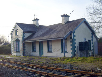 Lisnagry Railway StationRailway station · 895 yd
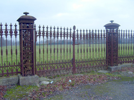 HermitageDemesne walls/gates/railings · 911 ydFulacht fia in GardenhillFulacht fia · 1147 yd
 Castle ConnellRuins · 1.2 mi
 Castle Connell (in ruins)Castle, Anglo-Norman masonry castle · 1.2 mi
 Jackie PowerMemorial · 2.4 miCampus MapVisitor information · 3.4 miCampus MapVisitor information · 3.5 miFountain SculptureHeritage attraction · 3.5 miOld PumpHeritage attraction · 4.0 miGraveyard in AbingtonGraveyard · 5.3 mi
More archaeology and monuments in County Limerick · All of County Limerick
What do you know about this place?