What is recorded here
In rough peaty hill pasture with occasional surface boulders, on the lower S-facing slopes of Hungry Hill. A circular area (9.4m E-W; 8.8m N-S) is defined by the jumbled remains of a partially sod-covered stone wall (T 1m; H 0.35m). The level interior is raised (H 1.3m) at S and cut into the upslope (D 0.7m) at N to compensate for the hillslope. Rubble is scattered along the perimeter, especially downslope to the S. Small mounds of stones to the W of the enclosure appear to be clearance cairns. A fulacht fia (CO116-034001-) lies c. 50m to the NW. Volume 5' (Dublin: Stationery Office, 2009).
In rough peaty hill pasture with occasional surface boulders, on the lower S-facing slopes of Hungry Hill. A circular area (9.4m E-W; 8.8m N-S) is defined by the jumbled remains of a partially sod-covered stone wall (T 1m; H 0.35m). The level interior is raised (H 1.3m) at S and cut into the upslope (D 0.7m) at N to compensate for the hillslope. Rubble is scattered along the perimeter, especially downslope to the…
From the National Monuments Service (Archaeological Survey of Ireland) record CO116-034002
The monument record does not grant public access. Check the route and ask the landowner before entering private land.
- What survives
- Recorded monument
Places near here
Photo credits
- National Inventory of Architectural Heritage
- Ericpol ( talk ), Wikimedia Commons · CC BY-SA 3.0
- Jeff Buck, Geograph · CC BY-SA 2.0
- Ernest Riordan, Geograph · CC BY-SA 2.0
- Adriaen van Diest, Wikimedia Commons · Public domain
- Towel401, Wikimedia Commons · CC BY-SA 4.0
- Gordon Hatton, Geograph · CC BY-SA 2.0
Settlement cluster in Park (bear By.)Settlement cluster · 994 ydCairnCairn, unclassified · 1023 yd post box1197 ydHungry HillMountain / peak · 1589 ydMare's Tail WaterfallViewpoint · 1.4 mibattery2.0 miTrawnablahaBeach / strand · 2.3 miTrawnablahaBeach / strand · 2.4 miKnocknagreeMountain / peak · 2.6 miBattle of Bantry BayMajor battlefield · 3.5 miBere IslandIsland · 4.1 miDinish IslandIslet · 5.1 mi
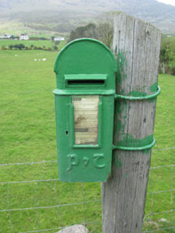 post box1197 yd
 Hungry HillMountain / peak · 1589 yd
 Mare's Tail WaterfallViewpoint · 1.4 mi
 battery2.0 miTrawnablahaBeach / strand · 2.3 miTrawnablahaBeach / strand · 2.4 mi
 KnocknagreeMountain / peak · 2.6 mi
 Battle of Bantry BayMajor battlefield · 3.5 mi
 Bere IslandIsland · 4.1 mi
 Dinish IslandIslet · 5.1 mi
More archaeology and monuments in County Cork · All of County Cork
What do you know about this place?