What is recorded here
Situated at the SW edge of a low-lying plateau, and at the crest of a steep slope down (H c. 10m) to a NW-SE section of the Blackwater River which is c. 60m distant. An enclosure (int. diam. c. 25m) defined by three ditches was excavated (E000162) by M. Cahill in 1977 in advance of mining operations that didn’t…
Read the whole record
From the National Monuments Service (Archaeological Survey of Ireland) record ME025-043001
Places near here
Photo credits
- National Inventory of Architectural Heritage
- Maker not stated on source page, en.wikipedia.org
- Maker not stated on source page, uk.pinterest.com
- JP, Geograph · CC BY-SA 2.0
- JP, Geograph · Creative Commons Attribution-ShareAlike 2.0
- Meath Chronicle; photographer not stated, www.meathchronicle.ie
 bridge1048 yd
Explorer Tom Bridge in Abbeyland carries the Kingscourt line over the Blackwater River with iron trestle beams that look like…
 Dun MhuireHouse · 1251 yd
Explorer Tom Dun Mhuire is a flat-roofed box from 1946 that looks like it lost a fight with a fridge. The dog inside probably runs…
 Liscartan CastleHouse, 16th/17th century · 1354 yd
Explorer Tom Liscartan Castle would get ‘Sorry About That’ on its tombstone because it kept falling over. It sits near the River…
 Enclosure in MoathillEnclosure · 1438 yd
Explorer Tom Enclosure in Moathill would post a selfie of its step-ditch with a very serious caption. It cuts through an older ring…
 Graveyard in LiscartanGraveyard · 1457 yd
Explorer Tom Graveyard in Liscartan hears everything through its walls, including the river Blackwater humming a tune it’s been…
 Church (in Ruins)Church · 1466 yd
Explorer Tom Church in Liscartan is guarding a ditch where a poet once fell flat on his face. He was writing a ballad, but the mud…
 weir1503 yd
Explorer Tom Weir in Abbeyland would be the uncle at the wedding who keeps interrupting the speeches. It’s been doing this since…
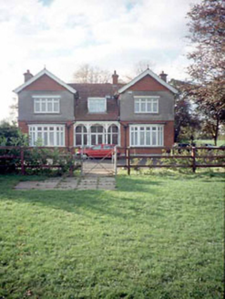 Mount RiversHouse · 1579 yd
Explorer Tom Mount Rivers in Townparks looks like it’s trying to be fancy with those gabled ends, but it’s just an Edwardian house…
 Moatlands HouseHouse · 1.0 mi
Explorer Tom Moatlands House in Townparks is playing hard to get, like it's got a secret recipe for soup. Built in 1896 with all…
 Blackwater MillMill (water) · 1.0 mi
Explorer Tom Blackwater Mill in Abbeyland South is still grinding flour in its dreams, hearing the ghosts of old gears clicking…
Enclosure in ClonmagaddanEnclosure · 1.0 miExplorer Tom Clonmagaddan’s enclosure has strong opinions about modern buildings, insisting they’re all just bad copies of its…
 O'Mahony's GAA, NavanGAA ground · 1.3 mi
More archaeology and monuments in County Meath · All of County Meath

What do you know about this place?Tap to add a comment or ask a question