DDiscover AloneMapAbout

Enclosure in Monaster North

Enclosure
Computer-made picture that does not show Enclosure in Monaster NorthNot a photo of this monument
Computer-made picture. It does not show this monument. · Report the wrong picture

The monument record does not grant public access. Check the route and ask the landowner before entering private land.

What do you know about this place?Tap to add a comment or ask a question

What you write will be public.

What is recorded here

In gently undulating low-lying pasture, overlooking the Camoge River to S, which also forms a townland boundary between Monaster North and South. Conjoined enclosures (LI031-010002-) known as the assembly place of Óenach Cairbre, lie 75m to NE. An ancient road (LI031-010001-) running NE-SW adjoins the monument to NW…

Read the whole record
In gently undulating low-lying pasture, overlooking the Camoge River to S, which also forms a townland boundary between Monaster North and South. Conjoined enclosures (LI031-010002-) known as the assembly place of Óenach Cairbre, lie 75m to NE. An ancient road (LI031-010001-) running NE-SW adjoins the monument to NW and leads from the conjoined enclosures to an earlier crossing point at Abbey bridge (LI031-009001-). Monaster Abbey (LI031-050004-) lies 135m to SSW, on the opposite side of the river and a burial mound (LI031-004----) referred to by Westropp (1920, 372) as Síd Asail lies 1km to NW and forms part of the ancient landscape of the Óenach Cairbre. Not depicted on OSi historic maps. Not annotated on Westropp’s sketch plan of Monasteranenagh, which depicts the assembly place of the ‘Oenach Cairbre’ and an ‘old road’ (Westropp 1920, 373). Possibly referred to by Begley (1906, 18) as ‘Oenach beg’: The Óenach [LI031-010002-], near Manstir abbey, on the north bank of the Camoge, with its large conjoined mounds and its sidh mound [LI031-004----] and other earthworks was Óenach Beg, the very term suggesting the existence of the great Oenach.’ In a later work, Westropp (1920, 372) describes the Óenach Cairbre territory as an ancient Celtic landscape and likens it to Tara, Telltown and Brugh na Bóinne in Co. Meath, Rathcroghan, Co. Roscommon, The Curragh, Co. Kildare and nearby Knockainey Hill, Co. Limerick. He goes on to explain the common features of such archaeological complexes which often include an assembly-place [LI031-010002-], a sanctuary and a cemetery [LI031-004----] in the form of tumuli, cairns, ring mounds and platform forts which are often conjoined, old roads [LI031-010001-] and water supply (ibid). Westropp (1920, 372, 373 & 375) confirms that, ‘An ancient roadway’ leads from a fording point on the Camoge River, to the pair of conjoined ringforts (LI031-010002-), to which he refers to as the assembly place of the Óenach Cairbre. According to Westropp (1920, 373) the ford marks an earlier crossing point known as ‘The Ford of the Chariots of Fergus’. Power (1930, 43-4) describes the earthen monuments in the vicinity of Oenach Cairbre as, ‘Ancient earthworks of considerable size and extent [that] crown a gentle elevation on the north bank of the stream nearly opposite the abbey; These may have had connection with the great fair and its associated Pagan rites’. Westropp (1920, 375) describes, ‘An old hollow way [LI031-010001-] which leads from it [LI031-010002-] towards the ford, and is 4 to 5 feet (1.2-1.5m) deep and 8-10 feet (2.4-3m) wide below. There are traces of an enclosure [LI031-010003-] between it and the river’. Monument is visible as a rectangular-shaped cropmark (L 40m NE-SW; 30m NW-SE) OSi aerial orthoimage taken 2005-2012, or on Digital Globe orthoimage taken 2011-2013 or on Google Earth orthoimage taken 14/02/2020. See attached Google Earth orthoimage, sketch plans by Westropp (1920, 373 & 374) and photographs taken by the ASI.

From the National Monuments Service (Archaeological Survey of Ireland) record LI031-010003

Places near here

Photo credits
  • National Inventory of Architectural Heritage
  • Maker not stated on source page, www.flickr.com
  • JohnArmagh, Wikimedia Commons · Public domain
  • Maker not stated on source page, co.pinterest.com
  • Maker not stated on source page, evoke.ie
  • Maker not stated on source page, ru.pinterest.com
  • Willow, Wikimedia Commons · CC BY 2.5
  • Maker not stated on source page, www.coliseum-online.com
  • Maker not stated on source page, www.dreamstime.com
Monaster BridgeBridge · 196 yd

Explorer Tom Monaster Bridge would tell its younger self to stop trying so hard with those cutwaters, mate. It’s a well-proportioned…

Monasteranenagh Abbey (in ruins)Religious house, Cistercian monks · 239 yd

Explorer Tom Monasteranenagh Abbey would cope badly on a reality show because it refuses to compromise its dour personality.…

Monasteranenagh AbbeyHeritage attraction · 270 yd

Explorer Tom Monasteranenagh Abbey rises from a Limerick field, where its ruined church and chapter house still make a large claim…

River ViewHouse · 325 yd

Explorer Tom River View in Monaster North is where Vikings got lost looking for the river instead of the view. The sliding sash…
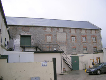
mill (water)517 yd

Explorer Tom Mill in Ballymacsradeen East is mixing limestone and corrugated iron like a weird fashion statement. It’s got that…

Ric barracks633 yd

Explorer Tom The RIC barracks in Ballymacsradeen East plans to retire by becoming a very serious art gallery. It spent decades…

Fairy fort / earthen ringfort in DunkipFairy fort / earthen ringfort · 1.0 mi

Explorer Tom Fairy fort / earthen ringfort in Dunkip hates modern buildings because they don’t have any manners. It sits in the…

Fairy fort / earthen ringfort in CloraneFairy fort / earthen ringfort · 1.2 mi

Explorer Tom Fairy fort / earthen ringfort in Clorane would win a county fair by simply existing and looking slightly damp. It’s…

Castle (in ruins)Castle, tower house · 1.6 mi

Explorer Tom Castle in Tullovin was saved by a hero nobody remembers, who just threw a rock at an attacker and ran home. The tower…

European ash1.9 mi

Explorer Tom European ash saw the most dramatic event when a squirrel dropped a nut on a priest’s head. It stands tall in Limerick…
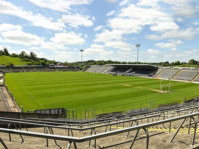
Camogue Rovers GAA pitchGAA ground · 2.1 miAnhid CemeteryCemetery · 2.1 mi

Explorer Tom Anhid Cemetery is run by a very serious dog who hasn't seen a human in years. He guards the gate with intense suspicion…

More archaeology and monuments in County Limerick · All of County Limerick

Add to this placeAdd a picture Add a detailed tip Add a story

Explore the map1,095,414 places to discover

Next place · or swipeMonaster Bridge