DDiscover AloneMapAbout

Monaster Bridge, County Limerick (LI031-009001-)

Bridge

What is recorded here

In gently undulating low-lying pasture, Monatser Bridge traverses the Camoge River, which also forms the townland boundary between Monaster North and South. An eel weir (LI031-009002-) lies 37m upriver to E. Depicted on the 17th century Down Survey map of Coshma braony as a bridge crossing over the ‘River Comoge’…

Read the whole record
In gently undulating low-lying pasture, Monatser Bridge traverses the Camoge River, which also forms the townland boundary between Monaster North and South. An eel weir (LI031-009002-) lies 37m upriver to E. Depicted on the 17th century Down Survey map of Coshma braony as a bridge crossing over the ‘River Comoge’ (Hib. Reg.). Recorded in the 1655-58 Civil Survey of Limerick where it is described as 'in the Parish of Mounester Inenie aforesaid and allong the said River of Cumoge to the bridge of Monester Inenie South east and from thence leading along the heighway Eastwards between the lands of Rathmore in the Barronie of smale Countie' (Simington 1938, 370). Westropp (1919, 19) refers to this structure as ‘The Abbey bridge’ given its proximity to Monaster Abbey (LI031-050004-) which lies 200m to SE. According to Westropp (1920, 373) this bridge marks an earlier fording point known as ‘The Ford of the Chariots of Fergus’. Described in 1840 as 'a bridge with 5 arches' (OSNB Monasteranenagh Parish, 1366). Monaster Bridge (NIAH Reg. No. 21903105) described by the National Inventory of Architectural Heritage [NIAH] as a 'Five-arch stone road bridge, built c. 1750, over the River Camoge, and possibly containing earlier fabric. Segmental-arched openings with dressed limestone voussoirs. Rubble limestone spandrel walls having dressed copings to parapet walls. V-cutwaters encased in concrete to upstream elevation. Surveyed by the ASI in 2007 and described as a bridge (L 22m; Wth 5.2m) comprising of four semi-circular arches, that to S being slightly smaller than the other three and a fifth dry arch further to S. The arches, intrados and springings are constructed of roughly hewn voussoirs. The fifth (dry) arch (Wth 2.2m; H 1.3m) is set 7m to S and carries the approach road over an uneven and poorly drained floodplain at the S-end. It has been infilled with masonry on the W-side, which is obscured by dense ivy on the exterior and is not visible. The main arches are supported on three rubble stone piers the bases of which have rendered with concrete just above the waterline as a scour protection measure. The concrete bases have pointed cut-waters on the upriver side to E to match the stone piers above which have pointed cut-waters of square cut limestone. The parapet wall (T 0.34m; H 0.85m) is constructed of roughly hewn limestone and has a vertical coping. It is covered in ivy over the S arch and most of the approach wall on the W-side. Parts of the approach wall to S have been recently reconstructed. A turn in the approach road is evident where the stones of the bridge are merged into a field boundary wall. According to local information, the river was last dredged at this point in 1978. Monument is visible as a linear road bridge running N-S across the Camoge River on OSi aerial orthoimage taken 2005-2012, on Digital Globe orthoimage taken 2011-2013 and on Google Earth orthoimage taken 28/06/2018. See attached photographs taken by the ASI Compiled by: Alison McQueen and Vera Rahilly Date of upload: 27 October 2020

From the National Monuments Service (Archaeological Survey of Ireland) record LI031-009001

The monument record does not grant public access. Check the route and ask the landowner before entering private land.

Official monument number
LI031-009001-
What do you know about this place?Tap to add a comment or ask a question

What you write will be public.

Places near here

Photo credits
  • JohnArmagh, Wikimedia Commons · Public domain
  • National Inventory of Architectural Heritage
  • Willow, Wikimedia Commons · CC BY 2.5
  • Kmcnamee, Wikimedia Commons · CC BY-SA 4.0
  • PAUL FARMER, Geograph · CC BY-SA 2.0
  • Mike Searle, Geograph · CC BY-SA 2.0
  • SteveODowd, Wikimedia Commons · CC BY-SA 4.0
  • EecherplazGinkgo06.jpg : Cayambe derivative work: Ginkgotree ( talk ), Wikimedia Commons · CC BY-SA 3.0
  • Callanmurphy, Wikimedia Commons · CC BY-SA 4.0
Burial GroundChildren's burial ground · 90 yd

Explorer Tom Burial Ground in Monaster South is full of tiny, serious ancestors. It’s been snubbing the famous abbey next door for…

Monasteranenagh AbbeyHeritage attraction · 278 yd

Explorer Tom Monasteranenagh Abbey rises from a Limerick field, where its ruined church and chapter house still make a large claim…

River ViewHouse · 321 yd

Explorer Tom River View in Monaster North is where Vikings got lost looking for the river instead of the view. The sliding sash…
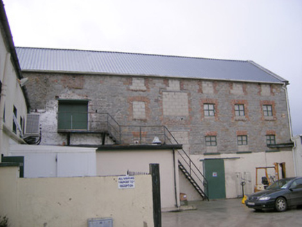
mill (water)458 yd

Explorer Tom Mill in Ballymacsradeen East is mixing limestone and corrugated iron like a weird fashion statement. It’s got that…

European ash1.3 mi

Explorer Tom European ash is thinking about what the builder was really thinking when they planted it here. It stands quietly in…

Camogue Rovers GAA pitchGAA ground · 2.1 miCastleCastle, Anglo-Norman masonry castle · 2.3 mi

Explorer Tom Castle in Croom loves singing 'Greensleeves' because it thinks it’s a medieval romance novel and not just a stone pile.…
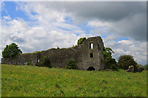
Glenogra Castle (in ruins)Castle, Anglo-Norman masonry castle · 2.7 mi

Explorer Tom Glenogra Castle thinks it’s much grander than its current pile-of-stones state suggests, probably because the seagulls…

Páirc Na nGael Cromadh, CroomGAA ground · 2.7 miDysert AenghusaHeritage attraction · 3.3 mi
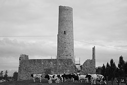
Explorer Tom Dysert Oenghusa near Croom brings a round tower, a ruined church and a graveyard together in one quiet Limerick field…

Ginkgo5.6 mi

Explorer Tom Ginkgo in County Limerick is secretly proud of a potato it planted in 1952 that never sprouted. It thinks this makes it…

Franciscan AbbeyArchaeological place · 5.8 mi

Explorer Tom The Franciscan Abbey is just a fancy backdrop for seagulls who think they own the roof tiles. The monks left centuries…

More historic places in County Limerick · All of County Limerick

Add to this placeAdd a picture Add a detailed tip Add a story

Explore the map1,095,414 places to discover

Next place · or swipeBurial Ground