
What is recorded here
From the National Monuments Service (Archaeological Survey of Ireland) record LH015-043001
Places near here
Photo credits
- National Inventory of Architectural Heritage
- Maker not stated on source page, uk.pinterest.com
- Kieran Campbell, Wikimedia Commons · CC BY-SA 2.0
- Maker not stated on source page, www.flickr.com
- Maker not stated on source page, en.wikipedia.org
- Maker not stated on source page, commons.wikimedia.org
 Bawn HouseSchool · 695 yd
Explorer Tom Bawn House has a prophecy that it would become a bakery, but it never did. The diamond pane windows are just fancy ways…
 Stone head in BawnStone head · 720 yd
Explorer Tom Stone head in Bawn nearly became a local celebrity during a particularly muddy harvest festival. The crowd cheered…
 St Marys ChurchChurch · 722 yd
Explorer Tom St Marys Church in Bawn is throwing a party but only invited stones older than your grandfather. The heads on the…
 Mansfieldstown CemeteryGraveyard · 722 yd
Explorer Tom Mansfieldstown Cemetery in County Louth is named after a man who definitely did not exist, probably just a typo by some…
 Mansfieldstown BridgeBridge · 824 yd
Explorer Tom Mansfieldstown Bridge was nearly sold for a horse in 1935 if the stones hadn’t objected. It’s got varied stone…
 Braganstown HouseCountry house · 982 yd
Explorer Tom Braganstown House thinks it’s Elizabethan but really it’s just playing dress-up in mid-nineteenth-century fancy dress.…
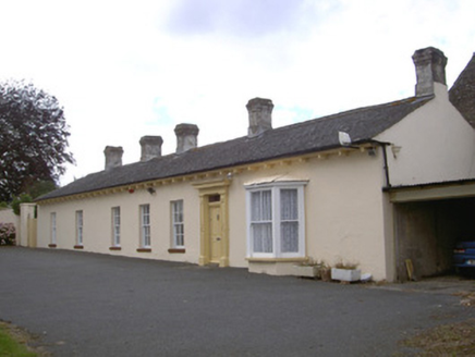 Newtown DarverFarm house · 1.2 mi
Explorer Tom Newtown Darver farm house in County Louth hears the cows gossiping through the thick walls at midnight. The walled…
 Earthwork in DrumcashelEarthwork · 1.2 mi
Explorer Tom Earthwork in Drumcashel in Louth is showing off its 37-metre diameter like it won a prize. It’s been minding its own…
 Fairy fort / earthen ringfort in Newrath (louth By., Dromiskin Par.)Fairy fort / earthen ringfort · 1.3 mi
Explorer Tom Fairy fort / earthen ringfort in Newrath sits on a ridge and thinks the local sheep are judging its fashion choices.…
 Church (in ruins)Church · 1.7 mi
Explorer Tom Church in Clonkeehan claims to be older than the concept of shoes, which I find highly suspicious given its flimsy…
 Graveyard in ClonkeehanGraveyard · 1.7 mi
Explorer Tom This graveyard in Clonkeehan is missing from every map, which is impressive for a place full of permanent residents. It…
 CastleCastle, unclassified · 1.8 mi
Explorer Tom Irishtown Castle is currently being judged by a very critical local sheep who thinks it’s overrated. The field is named…
More archaeology and monuments in County Louth · All of County Louth

What do you know about this place?Tap to add a comment or ask a question