
What is recorded here
'This site is situated in a small gently sloping field, around 180m east of the Big Stream, on the lower slopes of Knockawaddra Mountain. The field slopes gently from south to north and has been partially cultivated as a house vegetable garden on its western side. The centre of the field contains three separate…
Read the whole record
From the National Monuments Service (Archaeological Survey of Ireland) record KE038-108
Places near here
Photo credits
- Maker not stated on source page, www.dreamstime.com
- Maker not stated on source page, en.wikipedia.org
- Irish Examiner; individual photographer not stated on source page, www.irishexaminer.com
- National Inventory of Architectural Heritage
- Ian S, Geograph · CC BY-SA 2.0
- Maker not stated on source page, www.pinterest.com
- Maker not stated on source page, monumentalireland.ie
- Willow, Wikimedia Commons · CC BY 2.5
- John M, Wikimedia Commons · CC BY-SA 2.0
 Fairy fort / earthen ringfort in ClashedmondFairy fort / earthen ringfort · 706 yd
Explorer Tom Fairy fort / earthen ringfort in Clashedmond: I reckon they had to drink at least forty cups of tea just to keep the…
 Enclosure in Dromavally (trughanacmy By., Killorglin Ed)Enclosure · 1025 yd
Explorer Tom Enclosure in Dromavally in County Kerry is basically a flat circle of earth pretending to be something grander. A…
Enclosure in ClashedmondEnclosure · 1286 ydExplorer Tom Enclosure in Clashedmond was built by someone who was really thinking about their garden party invites all along. The…
 John Mitchels GAA pitchGAA ground · 1.0 mi
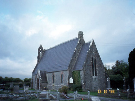 Ballyseedy ChurchChurch/chapel · 1.1 mi
Explorer Tom Ballyseedy Church would describe itself as 'gothic chic' to a stranger, leaning heavily on that rose window. It’s been…
 Ballyseede CastleGates/railings/walls · 1.3 mi
Explorer Tom Ballyseede Castle’s gateway took about four million cups of tea to build, judging by the intricate limestone piers. The…
 Standing stone in Camp (trughanacmy By., Ballyseedy Ed)Standing stone · 1.3 mi
Explorer Tom Standing stone in Camp is now a gatepost for a farmhouse, which is like using a crown jewel to hold the door open. It…
 Passage tomb in BallycartyPassage tomb · 1.3 mi
Explorer Tom Passage tomb in Ballycarty has a prophecy about finding treasure that never actually came true, sadly. It sits on a…
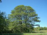 Common Alder1.3 mi
Explorer Tom Common Alder in County Kerry would be the awkward uncle at a wedding who stands by the buffet and says little. It loves…
 CastleCastle, unclassified · 1.7 mi
Explorer Tom Castle in Ballymacthomas is part of a group of four McElligott castles that probably hold regular meetings to complain…
 Bealagrellagh Castle (in ruins)Castle, tower house · 1.8 mi
Explorer Tom Bealagrellagh Castle is named after a ford in the mire, which suggests its builders had a really bad day with the mud…
 Scotia's GraveArchaeological place · 2.1 mi
Explorer Tom Scotia's Grave in County Kerry holds the fake world record for being the most confusingly named burial site in the…
More archaeology and monuments in County Kerry · All of County Kerry

What do you know about this place?Tap to add a comment or ask a question