
What is recorded here
On undulating ground in improved pasture on the E side of Ballyvaughan valley. Hachured on the 1840 ed. of the OS 6-inch map and listed as a ‘Rectangular enclosure’ in the RMP (1996). Inspection in 1998 could not identify any above ground trace. Cashels are located c. 120m to the E (CL005-047----) and NW (CL005-045----).
Compiled by: Mary Tunney and Ros Ó Maoldúin
Date of upload: 28 March 2022
The monument record does not grant public access. Check the route and ask the landowner before entering private land.
- What survives
- Recorded monument
Places near here
 OoanknocknagroaghFairy fort / stone ringfort · 153 yd
 CaherawarragaFairy fort / stone ringfort · 401 yd
 Newtown CastleCastle, tower house · 1176 yd
 Catholic Church of Saint John the Baptistchurch/chapel · 1334 yd
 Bird Of Prey CentreHeritage attraction · 1550 yd
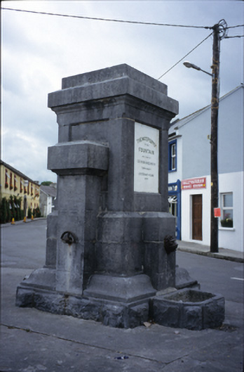 Ballyvaghan Fountainfountain · 1590 yd
 Aillwee CaveCave · 1.0 mi
 Ballyvaghan Castle (in ruins)Castle, unclassified · 1.1 mi
 Rine PointHeadland · 2.0 mi
 CappanawallaMountain / peak · 2.2 mi
 Gleninshing portal tombHeritage attraction · 2.6 mi
 PoulnabroneMemorial · 3.7 mi
Other information
Photo: Credit not shown in the picture search · Rights wording not checked; contact us if this picture should be removed