What is recorded here
In pasture, on moderate SE-facing slope of Caher Hill with excellent views from NW-SE. Megalithic structures (LI055-040/039----) lie 235m to the NE and 280m to the SW respectively. Depicted on the 1840 ed. OSi 6-inch map as a raised circular-shaped area, defined by a scarp. Shown on the 1897 ed. OSi 25-inch map as a raised roughly circular-shaped area defined by a scarp, incorporated into a field boundary from S-W-N-NE. Surveyed in 1999 and described as a raised sub-circular shaped area (dims. 26m N-S; 27.5m E-W) enclosed by a bank from S-W-NW (Overall Wth 3.5m; int. H 0.15m; ext. H 0.4m) reduced to a scarp (H 1.6m) that is quarried at NW and from E-S, with two depressions (diam. 10m) clearly visible. Interior slopes to SE, is raised to compensate for slope, dry and clear of overgrowth. Monument visible as a circular-shaped area enclosed by trees on Digital Globe orthoimage taken between 2011-2013 and on Google Earth orthoimages. See attached sketch plan surveyed and drawn by ASI and Google Earth orthoimages
Compiled by: Fiona Rooney
Date of upload: 19 November 2021
In pasture, on moderate SE-facing slope of Caher Hill with excellent views from NW-SE. Megalithic structures (LI055-040/039----) lie 235m to the NE and 280m to the SW respectively. Depicted on the 1840 ed. OSi 6-inch map as a raised circular-shaped area, defined by a scarp. Shown on the 1897 ed. OSi 25-inch map as a raised roughly circular-shaped area defined by a scarp, incorporated into a field boundary from…
From the National Monuments Service (Archaeological Survey of Ireland) record LI055-028
The monument record does not grant public access. Check the route and ask the landowner before entering private land.
- What survives
- Recorded monument
Places near here
Photo credits
- National Inventory of Architectural Heritage
- Andreas F. Borchert, Wikimedia Commons · CC BY-SA 4.0
- Colin Park, Geograph · CC BY-SA 2.0
- Mike Searle, Wikimedia Commons · CC BY-SA 2.0
- Mygodfrey at en.wikipedia, Wikimedia Commons · CC BY-SA 3.0
Burial mound in JamestownBurial mound · 338 yd post box622 ydBallyvoodane HouseHouse · 1.3 miBallinaboolaVisitor information · 1.8 mi‘Cloigtheach (Round Tower)’Round tower · 2.0 miSeefin Mountain West TopMountain / peak · 2.5 miToberSpring · 2.9 miLady's WellSpring · 2.9 miSeefin Mountain East TopMountain / peak · 3.1 miCastle OliverCastle · 3.9 miCastle OliverCastle · 3.9 miHoly Cross CemeteryGraveyard · 4.5 mi
 post box622 yd
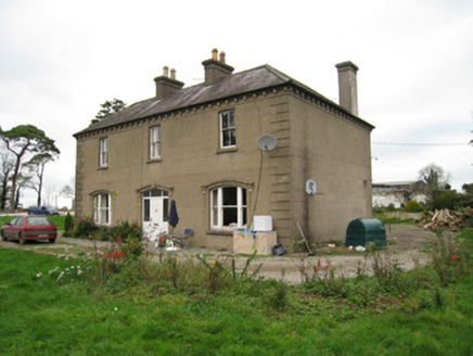 Ballyvoodane HouseHouse · 1.3 miBallinaboolaVisitor information · 1.8 mi
 ‘Cloigtheach (Round Tower)’Round tower · 2.0 mi
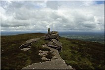 Seefin Mountain West TopMountain / peak · 2.5 miToberSpring · 2.9 miLady's WellSpring · 2.9 mi
 Seefin Mountain East TopMountain / peak · 3.1 mi
 Castle OliverCastle · 3.9 mi
.jpg/250px-Castle_Oliver_(1).jpg "Photo: Mygodfrey at en.wikipedia, Wikimedia Commons · CC BY-SA 3.0") Castle OliverCastle · 3.9 miHoly Cross CemeteryGraveyard · 4.5 mi
Castle OliverCastle · 3.9 miHoly Cross CemeteryGraveyard · 4.5 miMore archaeology and monuments in County Limerick · All of County Limerick
What do you know about this place?