What is recorded here
Not visible at ground level. Aerial photographs (GSI, N 179/78) shows cropmark of possible enclosure.
From the National Monuments Service (Archaeological Survey of Ireland) record OF025-021
The monument record does not grant public access. Check the route and ask the landowner before entering private land.
- What survives
- Recorded monument
Places near here
EntrenchmentEcclesiastical enclosure · 1.4 mi Killeigh Church (Geashill)Church/chapel · 1.5 miKilleigh Church (Geashill)Mausoleum · 1.5 miRed HillMountain / peak · 1.5 miMick the MillerMemorial · 1.5 miScrub HillMountain / peak · 1.9 miChurch (in Ruins), GraveyardChurch · 2.6 miCastle Brack (in ruins)Castle, tower house · 2.6 miSt. Bridgets WellHoly well · 4.4 miSpindle5.0 miPedunculate Oak5.0 miCharleville CastleCastle · 5.6 mi
 Killeigh Church (Geashill)Church/chapel · 1.5 mi
 Killeigh Church (Geashill)Mausoleum · 1.5 miRed HillMountain / peak · 1.5 mi
 Mick the MillerMemorial · 1.5 miScrub HillMountain / peak · 1.9 miChurch (in Ruins), GraveyardChurch · 2.6 miCastle Brack (in ruins)Castle, tower house · 2.6 mi
 St. Bridgets WellHoly well · 4.4 mi
 Spindle5.0 mi
 Pedunculate Oak5.0 mi
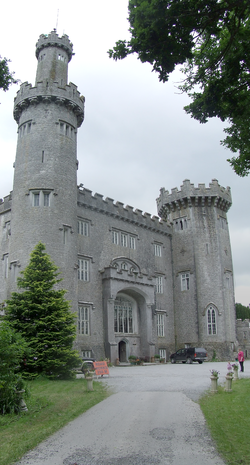 Charleville CastleCastle · 5.6 mi
Pictures: Trenchspike, Wikimedia Commons · CC BY-SA 4.0; National Inventory of Architectural Heritage; kevin higgins, Wikimedia Commons · CC BY-SA 2.0; A.-K. D., Wikimedia Commons · CC BY-SA 4.0; AnRo0002, Wikimedia Commons · CC0; Algirdas at Lithuanian Wikipedia, Wikimedia Commons · Public domain; User:Jgillett, Wikimedia Commons · Public domain
More archaeology and monuments in County Offaly · All of County Offaly
What do you know about this place?