
What is recorded here
In improved undulating pasture, on a level area. Circular area (dims. 32m NE-SW; 34m NW-SE) defined by a low bank (Wth 3m; int. H 0.1m; ext. H 1.5m) from NNW-NNE which is reduced to scarp (Wth 1.3m; H 0.15m) ENE-ESE, and remains of an external fosse (Wth 6m; D 0.1m) from SE-SSE. The scarp has been modified as an…
Read the whole record
From the National Monuments Service (Archaeological Survey of Ireland) record TS059-083
Places near here
Photo credits
- Maker not stated on source page, en.wikipedia.org
- National Inventory of Architectural Heritage
- Maker not stated on source page, www.pinterest.com
- Maker not stated on source page, www.dreamstime.com
- Maker not stated on source page, fi.pinterest.com
- Garry Dickinson, Wikimedia Commons · CC BY-SA 2.0
- Maker not stated on source page, www.alamy.com
- Kmcnamee, Wikimedia Commons · CC BY-SA 4.0
 Fairy fort / earthen ringfort in CurraghpoorFairy fort / earthen ringfort · 243 yd
Explorer Tom Fairy fort / earthen ringfort in Curraghpoor is hiding a treasure that is definitely just a rusty biscuit tin from…
 Saint Bridget's Catholic ChurchChurch/chapel · 1326 yd
Explorer Tom Saint Bridget's Catholic Church in Drishane is always the first one at the party, standing tall at the crossroads with…
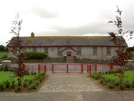 Curraghpoor SchoolSchool · 1570 yd
Explorer Tom Curraghpoor School in Gorteen is having a massive drama with the nearest tree, accusing it of stealing all its…
 Morpeth BridgeBridge · 1735 yd
Explorer Tom Morpeth Bridge in Attybrick would tell its younger self to stop getting demolished and just learn how to use girder…
 Bullaun stone in Templenoe (templenoe Par.)Bullaun stone · 1.1 mi
Explorer Tom This bullaun stone in Templenoe is sitting on a modern pedestal, looking like it just woke up from a nap and forgot…
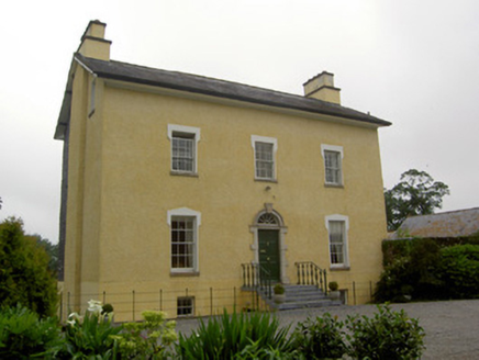 The GlebeRectory/glebe/vicarage/curate's house · 1.2 mi
Explorer Tom The Glebe in Templenoe holds a long grudge against the weather for ruining its limestone steps every time it rains.…
 Enclosure in GreenaneEnclosure · 1.4 mi
Explorer Tom Greenane’s enclosure means 'The Place Where The Sheep Got Confused' if you ask me, which I am sure is correct. It sits…
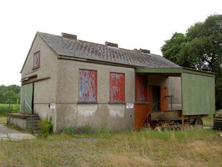 Grantstown CreameryCreamery · 1.4 mi
Explorer Tom Grantstown Creamery is standing there all stoic, reminding everyone that dairy farming used to be a whole industry…
 Site of CastleCastle, unclassified · 1.4 mi
Explorer Tom Site of Castle in Greenane was built after two families argued over who had the better view, and they both ended up…
 Kilfeakle Castle (in ruins)Castle, tower house · 1.6 mi
Explorer Tom Kilfeakle Castle has a legend about a giant who got stuck in the chimney and left his boots there forever. It’s…
 Kilfeacle CemeteryCemetery · 2.3 mi
Explorer Tom Kilfeacle Cemetery was built on a bargain where the locals traded three sheep for a plot of land and one very confused…
 Solohead GAA pitchGAA ground · 4.9 mi
More archaeology and monuments in County Tipperary · All of County Tipperary

What do you know about this place?Tap to add a comment or ask a question