What is recorded here
Cropmark of fosse of subcircular enclosure (c. 60m N-S; c. 50m E-W), with possible annexe to SE, visible in aerial photograph (CASAP, July 1989); part of complex of enclosures (13522,13737) and pits (13854). Investigated by Doody (1995, 26-9: Enclosure 1) using combination of topographic and geophysical survey and excavation as part of the Discovery Programme's Ballyhoura Hills Project. Fosse exposed in three cuttings; excavated only in NW cutting. Excavation revealed U-shaped fosse with slightly rounded base (Wth 3m at surface, tapering to 0.5m at base; D 1.8m); sides steeply cut, descending to step c. 0.6m above base at NW side and c. 0.25m above base at SE side. Fill of fosse comprised layers of dumped refuse and natural silting; burnt animal bones were recovered. Second cutting at SW side of enclosure revealed evidence of an internal bank in the form of a spread of redeposited boulder clay which partially covered the fosse. Deposit of large stones also overlay the fosse here and 'may represent the remains of a stone revetment against the bank or some other structure which was subsequently levelled into the partially infilled ditch' (ibid., 28); a furnace bottom was found in this deposit. Three post- or stake-holes cut into bank here 'were rich in charcoal and may represent the remains of uprights which had been burnt in situ' (ibid., 29). Part of a post-built structure was recorded outside the fosse to SE: five post-holes extended across the cutting in a NE-SW direction but due to the restrictive nature of the cutting the overall ground plan of the building was not apparent. Radiocarbon dating evidence from enclosure was problematic and inconclusive. Circular enclosure (13522) within S half of interior, which appears to be stratigraphically later in date; rectangular enclosure (13737) immediately to SW, which appears to be stratirgaphically earlier; complex of pits (13854) to NW, SW and S, several within the interior of the enclosure.
Cropmark of fosse of subcircular enclosure (c. 60m N-S; c. 50m E-W), with possible annexe to SE, visible in aerial photograph (CASAP, July 1989); part of complex of enclosures (13522,13737) and pits (13854). Investigated by Doody (1995, 26-9: Enclosure 1) using combination of topographic and geophysical survey and excavation as part of the Discovery Programme's Ballyhoura Hills Project. Fosse exposed in three…
From the National Monuments Service (Archaeological Survey of Ireland) record CO034-072001
The monument record does not grant public access. Check the route and ask the landowner before entering private land.
- What survives
- Recorded monument
Places near here
Photo credits
- National Inventory of Architectural Heritage
- Jonathan Thacker, Geograph · CC BY-SA 2.0
- The Speckled Bird, Wikimedia Commons · CC BY-SA 4.0
- VisionsofthePast, Wikimedia Commons · CC BY-SA 4.0
Blackwater (Avondhu) WayWalking route · 391 yd ConvamoreFarmyard complex · 598 ydConvamoreSteward's house · 614 ydIcehouse698 ydBallyhooly CastleCastle · 1588 ydPriest's WoodForest · 1613 ydJohnson's WoodForest · 1.1 miKnocknaskagh North TopMountain / peak · 2.4 miLiam BurkeMemorial · 2.7 miGraveyard in BoherashGraveyard · 3.8 miGlanworth CastleCastle · 3.8 miLabbacalleeWedge tomb · 3.9 mi
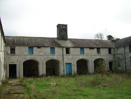 ConvamoreFarmyard complex · 598 yd
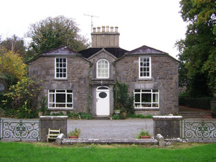 ConvamoreSteward's house · 614 ydIcehouse698 yd
 Ballyhooly CastleCastle · 1588 ydPriest's WoodForest · 1613 ydJohnson's WoodForest · 1.1 miKnocknaskagh North TopMountain / peak · 2.4 miLiam BurkeMemorial · 2.7 miGraveyard in BoherashGraveyard · 3.8 mi
 Glanworth CastleCastle · 3.8 mi
 LabbacalleeWedge tomb · 3.9 mi
More archaeology and monuments in County Cork · All of County Cork
What do you know about this place?