
What is recorded here
Located just off the summit of a hill on a SE-facing slope. A circular embanked enclosure (ext. diam. c. 45m) is depicted faintly on the 1836 edition of the OS 6-inch map where it is described as a ‘Fort’, and a rectangular hachured feature (dims c. 65m NW-SE; c. 40m NE-SW) is depicted on the 1912 edition of the map.…
Read the whole record
From the National Monuments Service (Archaeological Survey of Ireland) record ME041-002
Places near here
Photo credits
- Maker not stated on source page, commons.wikimedia.org
- Maker not stated on source page, en.wikipedia.org
- National Inventory of Architectural Heritage
- Sherry FitzGerald Royal / MyHome.ie; photographer not stated, www.myhome.ie
- Maker not stated on source page, www.mysteriousbritain.co.uk
- James Allan, Wikimedia Commons · CC BY-SA 2.0
- Mike Searle, Geograph · CC BY-SA 2.0
 Earthwork in BallivorEarthwork · 1673 yd
Explorer Tom Earthwork in Ballivor is playing hard to get, sitting on a ridge like it’s too cool for the map. It’s oval-shaped and…
 Earthwork in Robinstown (lune By.)Earthwork · 1.2 mi
Explorer Tom Earthwork in Robinstown smells like old mud and regret, which is basically the same thing. It’s an oval mound that used…
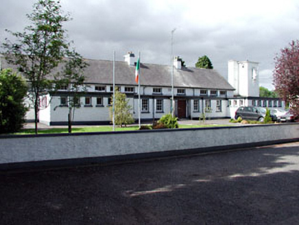 Saint Columbanus's National SchoolSchool · 1.4 mi
Explorer Tom Saint Columbanus's National School in Killaconnigan was built on a bargain where the flat roofs traded their dignity…
 Ballivor GAAGAA ground · 1.4 mi
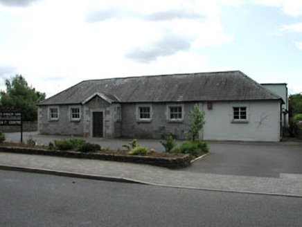 Ballivor National SchoolSchool · 1.4 mi
Explorer Tom Ballivor National School in Killaconnigan is showing off its limestone like it’s wearing a tuxedo. Its least favourite…
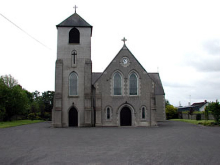 Saint Columbanus's Catholic ChurchChurch/chapel · 1.5 mi
Explorer Tom Saint Columbanus's Catholic Church in Kilballivor seems to suspect the postman of stealing its holy relics. It’s got…
 Church in KillaconniganChurch · 1.5 mi
Explorer Tom Church in Killaconnigan is sitting on a rise acting like it knows exactly what it would get on its tombstone: 'Finally…
 Saint Kineth's Church (Killaconnigan)Church/chapel · 1.5 mi
Explorer Tom Saint Kineth's Church in Kilballivor has won the Lotto and bought new railings. It’s showing off its traceried windows…
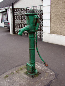 water pump1.6 mi
Explorer Tom Water pump in Kilballivor has banding and fluting that make it look more decorative than functional. It used to be…
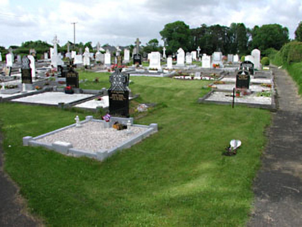 graveyard/cemetery1.7 mi
Explorer Tom This Kilballivor graveyard describes itself as 'quietly chaotic' to any stranger who gets lost nearby. The carved…
 Donore CastleCastle · 2.3 mi
Explorer Tom Donore Castle is in a bitter feud with the next village over something as daft as a missing fence post. They’ve stopped…
 CastleCastle, tower house · 2.3 mi
Explorer Tom Castle in Donore is playing hide-and-seek with me, but I think it’s hiding behind its own ego. A local claims he…
More archaeology and monuments in County Meath · All of County Meath

What do you know about this place?Tap to add a comment or ask a question