
What is recorded here
Located on a slight rise in a level landscape. A church at Killocanegan is listed in the ecclesiastical taxation (1302-06) of Pope Nicholas IV (Cal. doc. Ire., 5, 256). Ussher (1622) describes the church as in reasonable repair, but the chancel was a ruin (Erlington 1847-64, 1, lxxxiv). According to Dopping (1682-5)…
Read the whole record
From the National Monuments Service (Archaeological Survey of Ireland) record ME035-010
Places near here
Photo credits
- National Inventory of Architectural Heritage
- Maker not stated on source page, www.irishamericanmom.com
- Maker not stated on source page, en.wikipedia.org
- Sherry FitzGerald Royal / MyHome.ie; photographer not stated, www.myhome.ie
- James Allan, Wikimedia Commons · CC BY-SA 2.0
- Mike Searle, Geograph · CC BY-SA 2.0
- Malene Thyssen, Wikimedia Commons · CC BY-SA 3.0
- Alvesgaspar, Wikimedia Commons · CC BY-SA 3.0
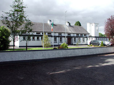 Saint Columbanus's National SchoolSchool · 916 yd
Explorer Tom Saint Columbanus's National School in Killaconnigan was built on a bargain where the flat roofs traded their dignity…
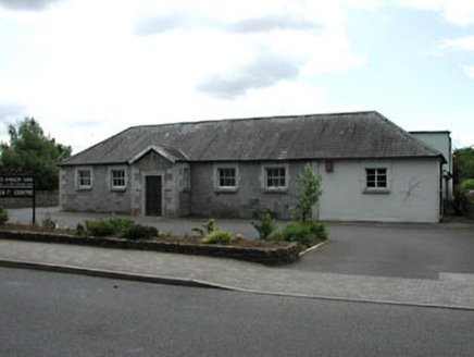 Ballivor National SchoolSchool · 977 yd
Explorer Tom Ballivor National School in Killaconnigan is showing off its limestone like it’s wearing a tuxedo. Its least favourite…
 Fairy fort / earthen ringfort in Carranstown GreatFairy fort / earthen ringfort · 978 yd
Explorer Tom Fairy fort / earthen ringfort in Carranstown Great bragged about surviving a storm that only existed in its…
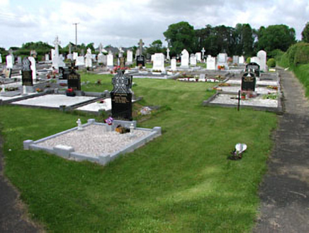 graveyard/cemetery1224 yd
Explorer Tom This Kilballivor graveyard describes itself as 'quietly chaotic' to any stranger who gets lost nearby. The carved…
 Earthwork in Robinstown (lune By.)Earthwork · 1257 yd
Explorer Tom Earthwork in Robinstown smells like old mud and regret, which is basically the same thing. It’s an oval mound that used…
 Ballivor GAAGAA ground · 1281 yd
 Saint Kineth's Church (Killaconnigan)Church/chapel · 1366 yd
Explorer Tom Saint Kineth's Church in Kilballivor has won the Lotto and bought new railings. It’s showing off its traceried windows…
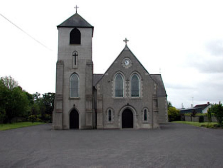 Saint Columbanus's Catholic ChurchChurch/chapel · 1434 yd
Explorer Tom Saint Columbanus's Catholic Church in Kilballivor seems to suspect the postman of stealing its holy relics. It’s got…
 Donore CastleCastle · 3.4 mi
Explorer Tom Donore Castle is in a bitter feud with the next village over something as daft as a missing fence post. They’ve stopped…
 CastleCastle, tower house · 3.4 mi
Explorer Tom Castle in Donore is playing hide-and-seek with me, but I think it’s hiding behind its own ego. A local claims he…
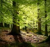 European Beech4.0 mi
Explorer Tom European Beech in County Meath is sick of people asking if it talks to the other trees; yes, they gossip, shut up. It’s…
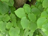 Common Lime4.1 mi
Explorer Tom Common Lime in County Meath once hid a crate of smuggled whiskey in its roots during a particularly rainy century. The…
More historic places in County Meath · All of County Meath

What do you know about this place?Tap to add a comment or ask a question