
What is recorded here
From the National Monuments Service (Archaeological Survey of Ireland) record OF039-011
Places near here
Photo credits
- Maker not stated on source page, www.pinterest.com
- Maker not stated on source page, en.wikipedia.org
- Maker not stated on source page, www.alamy.com
- Maker not stated on source page, www.orminatours.com
- National Inventory of Architectural Heritage
- Maker not stated on source page, commons.wikimedia.org
- Maker not stated on source page, ru.wikipedia.org
- Maker not stated on source page, www.markholan.org
 Stone trough in Cumber LowerStone trough · 1603 yd
Explorer Tom Stone Trough in Cumber Lower looks like something designed by a very strict mother-in-law. The face carved into the end…
 Standing stone in GlenafellyStanding stone · 1649 yd
Explorer Tom They call this the Fiddlers Rock, which means someone played air guitar on it and died of embarrassment. It’s just a…
 Mapped cemeteryCemetery · 1663 yd
Explorer Tom Mapped cemetery in County Offaly is the sort of spot a local might claim he invented back in the day, probably over a…
 Glenafelly Forest Recreation AreaPark · 1729 yd
Explorer Tom Glenafelly Forest Recreation Area in County Offaly is exactly what Saint Patrick would call 'a bit much' after one…
 Tulla HouseFarm house · 1.1 mi
Explorer Tom Tulla House is hiding a scandal where it allegedly ate all the potatoes in 1920 without saying sorry. It sits on the…
 Bullaun stone in Cumber UpperBullaun stone · 1.1 mi
Explorer Tom Bullaun stone in Cumber Upper is jealous of the famous holy wells down south for having better marketing. It has two…
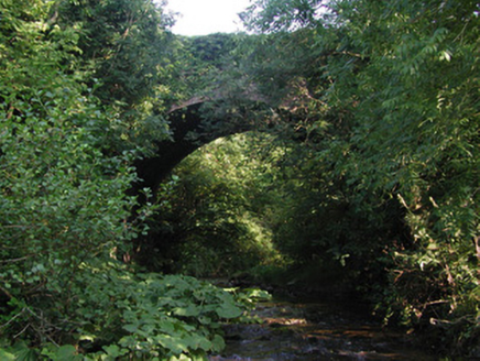 Aghagurty BridgeBridge · 1.2 mi
Explorer Tom Aghagurty Bridge in Newtown took four hundred cups of tea to build, according to local legend. It spans a deep valley…
 Fairy fort / earthen ringfort in LismoneyFairy fort / earthen ringfort · 1.2 mi
Explorer Tom Fairy fort / earthen ringfort in Lismoney is a D-shaped ditch that refuses to admit it's half-finished. The bishop…
 Standing stone in AghagurtyStanding stone · 1.6 mi
Explorer Tom Aghagurty’s standing stone is invisible at ground level, which is a bit cheeky for something marked as a large stone in…
 Enclosure in DerrykeelEnclosure · 1.6 mi
Explorer Tom Enclosure in Derrykeel is hiding under the grass like a shy cat. It claims to have survived a massive storm, but…
 Carrolls CastleRuins · 4.3 mi
Explorer Tom Carrolls Castle in County Offaly is basically a playground for rabbits who have no respect for history. They’ve turned…
 Killyon Abbey (in ruins)House, fortified house · 4.4 mi
Explorer Tom Killyon Abbey in Ballinree is playing hide-and-seek with me. A tale from 1846 says an earl built it, but there was no…
More archaeology and monuments in County Offaly · All of County Offaly

What do you know about this place?Tap to add a comment or ask a question