
What is recorded here
From the National Monuments Service (Archaeological Survey of Ireland) record TS069-064
Places near here
Photo credits
- Maker not stated on source page, commons.wikimedia.org
- National Inventory of Architectural Heritage
- Mike Searle, Geograph · Creative Commons Attribution-ShareAlike 2.0
- Maker not stated on source page, www.pinterest.com
- Maker not stated on source page, www.tripadvisor.com.au
- Rockwell Rovers / Tipperary GAA club profile; individual photographer not named, tipperary.gaa.ie
- Maker not stated on source page, en.wikipedia.org
- Benutzer:StefanServos, Wikimedia Commons · CC BY-SA 3.0
 Earthwork in Caddlestown,springfield (knockgraffon Par.)Earthwork · 520 yd
Explorer Tom Caddlestown has an earthwork that bragged about surviving storms but mostly just survived being forgotten by the…
 Site of Black CastleArchaeological place · 1.0 mi
Explorer Tom Site of Black Castle has a family tree so convoluted it looks like a game of Twister played with historical figures and…
 Ballinattin HouseHouse · 1.3 mi
Explorer Tom Ballinattin House in Ballinattin Upper has had so many former names it’s lost its own identity completely. It’s a…
 Ballydoyle Castle (in Ruins)Castle · 1.4 mi
Explorer Tom Ballydoyle Castle is sitting next to a horse training track, which means its tombstone should read: 'Died of…
 Castle (in ruins)Castle, tower house · 1.4 mi
Explorer Tom Castle in Ballydoyle is currently in a feud with the nearest tree because it thinks the branches are blocking its view.…
 Church in Ballinattin Lower,ballinattin UpperChurch · 1.5 mi
Explorer Tom The weather has had a long grudge against this church in Ballinattin, turning it into a farmhouse so the rain can stop…
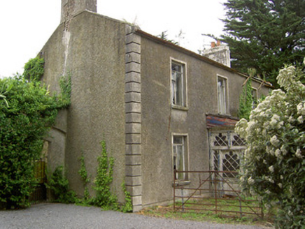 Shanballyard HouseHouse · 1.6 mi
Explorer Tom Shanballyard House is modest in size but surrounded by farm buildings that are still working hard today. It has a…
 Fairy fort / earthen ringfort in Rathmacarty WestFairy fort / earthen ringfort · 1.9 mi
Explorer Tom Fairy fort / earthen ringfort in Rathmacarty West had a week where a fox took full charge and rearranged the entrance…
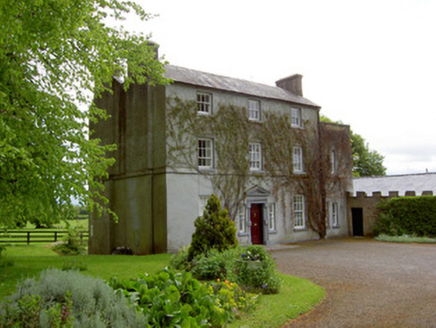 The GlebeRectory/glebe/vicarage/curate's house · 2.0 mi
Explorer Tom The Glebe in Graigue handles a nosey neighbour by simply pretending not to be there, which works surprisingly well for…
 Páirc na nGael, Rockwell RoversGAA ground · 2.0 mi
 Church in DecoyChurch · 2.0 mi
Explorer Tom Church in Decoy is known as Mocuana’s Church, which sounds like a name invented by someone who’d had three pints too…
 Cahir CastleCastle · 5.6 mi
Explorer Tom Cahir Castle. Right, so this is the real deal, one of the largest castles in the whole country. We’re talking Conchobar…
More archaeology and monuments in County Tipperary · All of County Tipperary

What do you know about this place?Tap to add a comment or ask a question