
What is recorded here
Within a modern, level farmyard, abutting a vernacular farmyard to N. Depicted on the 1840 edition of the OS 6-inch map as a circular hachured area (c. 30m N-S; c. 32m E-W) defined by a single bank. Not visible at ground level. The ground has been built up across this location to make a level farmyard surface. Modern sheds and structures are built at this location upon the ‘made ground’ where the ground level has been raised along the SE and NE sides of the farmyard to compensate for hillslope. As the whole area beneath the modern farmyard is artificially raised, it is likely that the levelled monument still exists below this, albeit heavily compacted.
Compiled by: Mary Tunney, Alison McQueen and Vera Rahilly
Date of upload: 4 July 2018
A local fairy fort (ringfort/rath); wider significance not recorded.
The monument record does not grant public access. Check the route and ask the landowner before entering private land.
- What survives
- Recorded monument
Places near here
 Bunavory Castle (in ruins)Castle, unclassified · 288 yd
 Enclosure in Tulla (tulla Upper By.),bunavoryEnclosure · 596 yd
 The StablesGallery · 890 yd
 Saint Mochulla's Church (Tulla)graveyard/cemetery · 933 yd
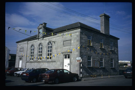 Tulla Courthousecourt house · 1172 yd
 Enclosure in MilltownEnclosure · 1204 yd
 Tulla Castle (Site of)Castle, unclassified · 1400 yd
 Cloghleagh RockNamed rock · 3.0 mi
 The RingfortHeritage attraction · 4.2 mi
 Derrymore WoodWood · 4.5 mi
 HawthornHawthorn · 8.4 mi
 G.A.A. Commemorative StoneMemorial · 9.0 mi
Other information
Photo: Credit not shown in the picture search · Rights wording not checked; contact us if this picture should be removed