
What is recorded here
From the Northern Ireland Sites and Monuments Record record ANT026:005
Places near here
Photo credits
- Maker not stated on source page, commons.wikimedia.org
- S. M. S., Wikimedia Commons · Public domain
- Maker not stated on source page, en.wikipedia.org
- Maker not stated on source page, www.thearchaeologist.org
- Maker not stated on source page, monumentalireland.ie
- Kenneth Allen, Wikimedia Commons · CC BY-SA 2.0
- Maker not stated on source page, theirishaesthete.com
- Kenneth Allen, Geograph · CC BY-SA 2.0
 Bier stone? in LisheeganBier Stone? · 1407 yd
Explorer Tom Bier stone? in Lisheegan has a strong opinion about the potholes on the road leading up to it. It thinks they’re an…
 Craigs DolmenArchaeological place · 1.4 mi
Explorer Tom Craigs Dolmen is a giant stone table that’s been sitting there so long it probably hears every secret whispered in its…
 Passage tomb: craigs dolmen in CraigsPassage Tomb: Craigs Dolmen · 1.4 mi
Explorer Tom Passage tomb: Craigs dolmen in Craigs would write 'seeks someone with patience' on its dating profile. It’s been…
 Holy well; with possible fortified outcrop; church site; Man-made underground passage: drumbolcan in Carnfinton, RasharkinHoly Well · 1.4 mi
Explorer Tom Holy well at Drumbolcan has a church site and an underground passage that smells like old socks. The first owner’s…
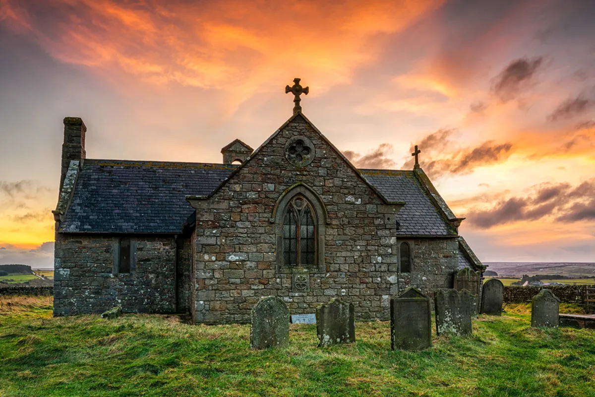 Medieval and post-medieval church (in ruins); modern church & graveyard & possible Man-made underground passage: rasharkin or rosserkan in Glebe (rasharkin)Medieval and post-medieval church (in ruins) · 1.6 mi
Explorer Tom Rasharkin or rosserkan in Glebe refuses to fall down because it has a stubborn streak that goes deeper than its…
 The Broad Stone (Craigs)Archaeological place · 1.7 mi
Explorer Tom The Broad Stone (Craigs) is playing hide-and-seek with me in County Antrim, and it’s winning big time. It’s so…
Court tomb: the broad stone in CraigsCourt Tomb: the Broad Stone · 1.7 miExplorer Tom Court tomb: the broad stone in Craigs has a long list of former names, all equally boring. It’s prehistoric and…
Standing stone in CraigsStanding Stone · 2.0 miExplorer Tom Saint Patrick supposedly looked at this stone in Craigs and said, 'That’s a bit much for one piece of rock.' It’s been…
 Kilrea BridgeBridge · 2.2 mi
Explorer Tom Kilrea Bridge in Antrim has spent centuries carrying traffic while secretly hoping someone would stop and appreciate…
 Locks PortnaCanal Structure · 2.4 mi
Explorer Tom Locks Portna is a canal structure with a family tree full of made-up stories about who built what. It’s just there…
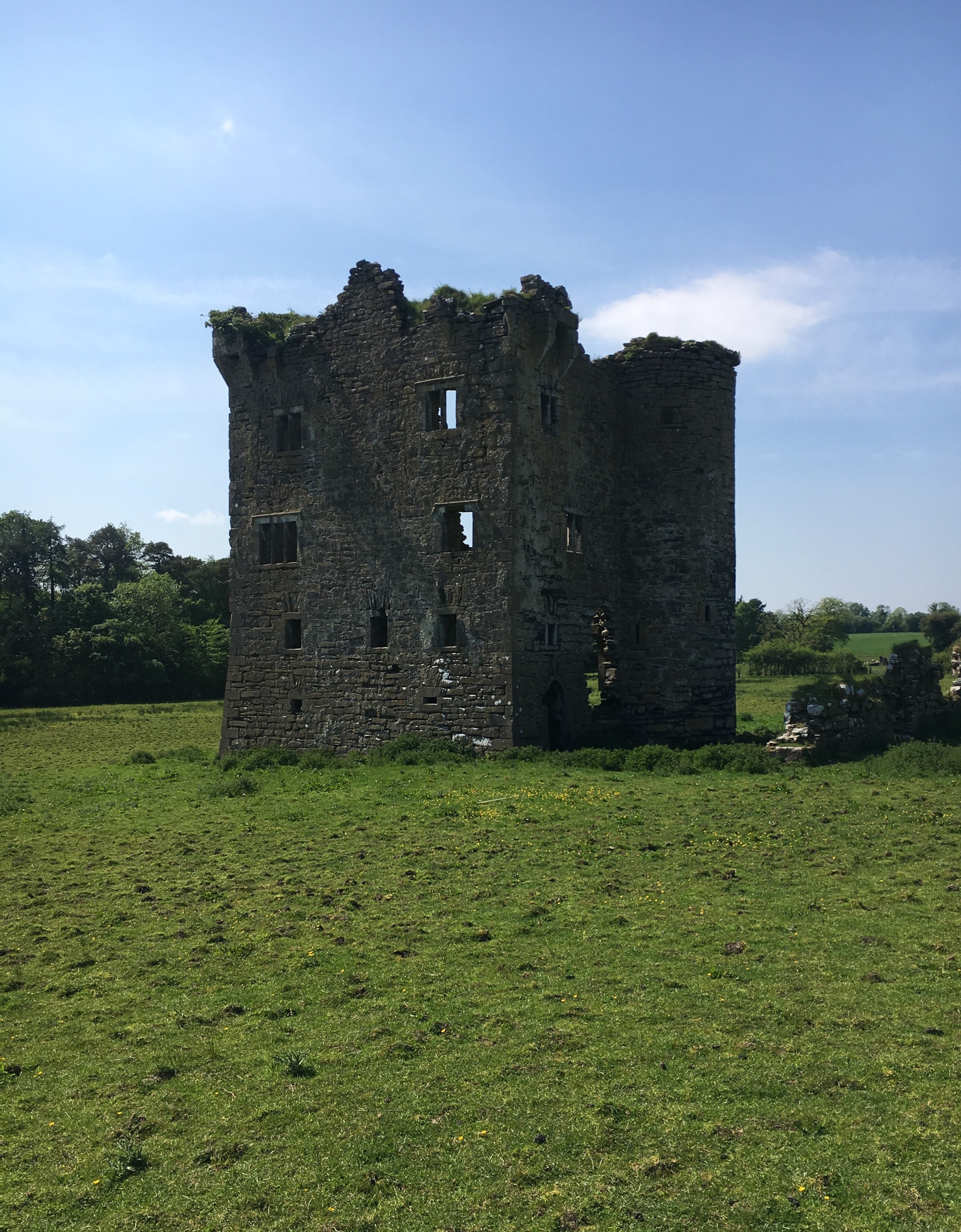 Plantation Castle; Bawn; Village Site: Movanagher Castle in MovanagherPlantation Castle · 2.8 mi
Explorer Tom Movanagher Castle is picking on the wind because it can’t pick on anyone else, so just let it have that. The bawn looks…
 Church & Graveyard: Kilrea Old Church or Kilrea O'diamond in KilreaChurch & Graveyard: Kilrea Old Church or Kilrea O'diamond · 3.0 mi
Explorer Tom Kilrea’s old church is also called O'Diamond, which sounds like a family dispute over a gemstone. According to Tom, it…
More archaeology and monuments in County Antrim · All of County Antrim

What do you know about this place?Tap to add a comment or ask a question