What is recorded here
In improved pasture, on a NW-facing slope. Excellent views WSW-NE. Depicted on 1840 OS 6-inch map as a circular enclosure (overall diam. c. 30m). No visible surface trace of monument. Enclosure (TS066-109----) is c. 30m to SE and enclosure (TS066-110----) is c. 120m to ESE.
Compiled by: Jean Farrelly
Date of upload: 26 August 2011
The monument record does not grant public access. Check the route and ask the landowner before entering private land.
- What survives
- Recorded monument
Places near here
 MoatCastle, motte · 1313 yd
 CastleCastle, ringwork · 1320 yd
 Site of Bruis ChurchChurch · 1384 yd
 Mount Bruishouse · 1441 yd
 Enclosure in Ballynagleragh,toor (bruis Par.)Enclosure · 1561 yd
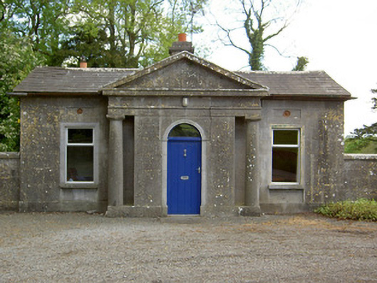 Mooresfort Housegate lodge · 1620 yd
 SlievenamuckMountain / peak · 1.7 mi
 Bansha ForestForest · 2.6 mi
 Knockanebrack HillMountain / peak · 3.8 mi
 Carn (site of)Cairn, burial cairn · 3.8 mi
 Glen of AherlowViewpoint · 3.9 mi
 Christ the KingViewpoint · 3.9 mi