What is recorded here
Situated on a break in a NE slope in undulating terrain planted with barley. Depicted on the 1st ed. (1843) OS 6-inch map as a circular enclosure and on the subsequent 1903 ed. as a rectangular area. The site has been levelled and only a roughly oval rise could be distinguished where the site once stood. Vol. 1 - North Tipperary' compiled by Jean Farrelly and Caimin O'Brien (Dublin: Stationery Office, 2002).
From the National Monuments Service (Archaeological Survey of Ireland) record TN015-084
The monument record does not grant public access. Check the route and ask the landowner before entering private land.
- What survives
- Recorded monument
Places near here
Photo credits
- National Inventory of Architectural Heritage
- Mike Searle, Wikimedia Commons · CC BY-SA 2.0
- David P Howard, Geograph · CC BY-SA 2.0
- Jonjobaker, Wikimedia Commons · CC BY-SA 4.0
- David P Howard, Geograph · Creative Commons Attribution-ShareAlike 2.0
Enclosure in MiddlewalkEnclosure · 923 ydBallycapple WoodForest · 1709 yd Clermont HouseCountry house · 1.1 miGlenahilty National SchoolSchool · 1.2 miJames Devaney MemorialMemorial · 1.7 miThomas MacDonagh Heritage CentreMuseum · 3.4 miMacDonagh HouseMemorial · 3.4 miKnockanacree WoodForest · 4.2 miKnockane CastleCastle · 4.4 miKnigh Castle (in ruins)Castle, tower house · 4.6 miNenagh Heritage CentreMuseum · 5.1 miChurch (in Ruins)Graveyard · 5.1 mi
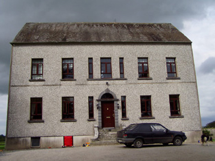 Clermont HouseCountry house · 1.1 mi
 Glenahilty National SchoolSchool · 1.2 miJames Devaney MemorialMemorial · 1.7 miThomas MacDonagh Heritage CentreMuseum · 3.4 miMacDonagh HouseMemorial · 3.4 miKnockanacree WoodForest · 4.2 mi
 Knockane CastleCastle · 4.4 mi
 Knigh Castle (in ruins)Castle, tower house · 4.6 mi
 Nenagh Heritage CentreMuseum · 5.1 mi
 Church (in Ruins)Graveyard · 5.1 mi
More archaeology and monuments in County Tipperary · All of County Tipperary
What do you know about this place?