What is recorded here
Marked only on the 1925 ed. of the OS 6-inch map as an arc of hachures NW-NE (C c. 70m). It is located toward the top of a W-facing slope down to the NNE-SSW Aughnascallop stream which is c. 300m to the W. It is not visible at ground level in pasture, but there is a slight curve (C. c. 30m) in a NW-SE field bank and townland boundary with Ballybrack.
From the National Monuments Service (Archaeological Survey of Ireland) record WX040-035
The monument record does not grant public access. Check the route and ask the landowner before entering private land.
- What survives
- Recorded monument
Places near here
Photo credits
- National Inventory of Architectural Heritage
- Mike Searle, Geograph · CC BY-SA 2.0
- Eirian Evans, Geograph · Creative Commons Attribution-ShareAlike 2.0
- cisko66, Wikimedia Commons · CC BY 3.0
- A.-K. D., Wikimedia Commons · CC BY-SA 4.0
- Oliver Dixon, Geograph · CC BY-SA 2.0
- Paul O'Farrell, Geograph · CC BY-SA 2.0
- Andreas F. Borchert, Wikimedia Commons · CC BY-SA 4.0
 mill (water)1054 yd
 Mullinderry BridgeBridge · 1270 yd
 Black Castle (in ruins)Castle, tower house · 2.6 mi
 IndicatedBawn · 2.6 mi
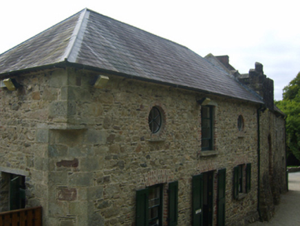 Tintern AbbeyStables · 4.3 mi
 Tintern AbbeyBuilding misc · 4.3 mi
 Grave YardGraveyard · 4.3 mi
 Lady WellHoly well · 4.4 mi
 Blackhall StrandBeach / strand · 5.9 mi
 Grange BeachBeach / strand · 6.2 mi
 Keeragh IslandsIsland · 7.1 mi
 Baginbun HeadHeadland · 8.4 mi
More archaeology and monuments in County Wexford · All of County Wexford
What do you know about this place?