
What is recorded here
From the National Monuments Service (Archaeological Survey of Ireland) record MA103-011
Places near here
Photo credits
- National Inventory of Architectural Heritage
- Maker not stated on source page, au.pinterest.com
- Maker not stated on source page, tr.pinterest.com
- Maker not stated on source page, cl.pinterest.com
- Maker not stated on source page, za.pinterest.com
- Maker not stated on source page, in.pinterest.com
- Maker not stated on source page, commons.wikimedia.org
- James Killeen / Mayo Football Talk, www.mft.ie
- Kmcnamee, Wikimedia Commons · CC BY-SA 4.0
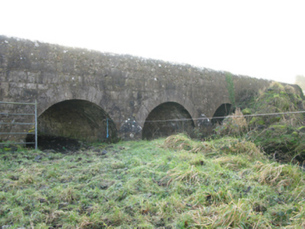 Agloragh BridgeBridge · 451 yd
Explorer Tom Agloragh Bridge has a curse that only affects people who don't wave at it when they pass. It replaced an older bridge…
 CastleCastle, unclassified · 1240 yd
Explorer Tom There was a fiddler at Castle in Bellaveel who played so loud he scared the walls right out of alignment. He left…
 Megalithic structure in Grallagh (costello By.)Megalithic structure · 1564 yd
Explorer Tom Megalithic structure in Grallagh was removed in the 1980s because some fox took charge and decided it needed a new…
 Church in Cottage (costello By.)Church · 1695 yd
Explorer Tom Church in Cottage is holding a fake world record for 'Most Likely Church to Be Nowhere Near Where You Think It Is.' The…
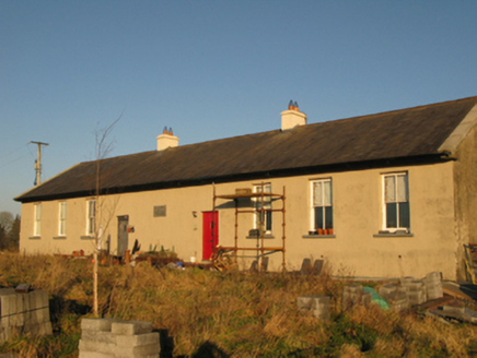 Saint Joseph's National SchoolSchool · 1.0 mi
Explorer Tom Saint Joseph's National School in Derrylea has an imaginary fan club that shows up every Tuesday to eat crisps and…
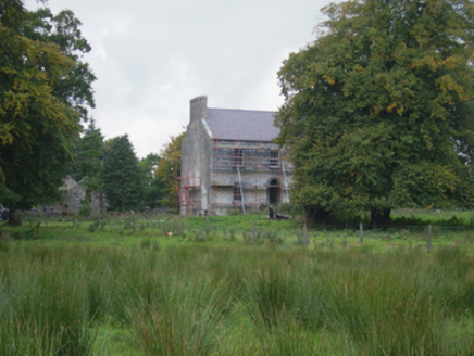 Holywell HouseFarm house · 1.1 mi
Explorer Tom Holywell House in Holywell Lower seems to have wandered into the wrong century entirely. It’s Georgian chic in a place…
 Church in Grallagh (costello By.)Church · 1.2 mi
Explorer Tom Church in Grallagh is deeply suspicious of the postman and his little envelopes. It thinks they’re all bills for…
 St. Patricks Church (Site of)Church · 1.3 mi
Explorer Tom St. Patricks Church has no visible trace, which is quite the bold move for a building. It probably thinks the road…
 Graveyard in ChurchparkGraveyard · 1.5 mi
Explorer Tom Graveyard in Churchpark rates every visitor’s outfit from one to ten based on how muddy their boots get. It’s a strict…
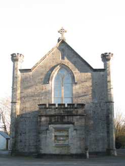 Saint Mary's Catholic ChurchChurch/chapel · 1.7 mi
Explorer Tom Saint Mary's Catholic Church in Lugboy Demesne has a treasure hidden inside, which is definitely just a biscuit tin…
 Ballyhaunis GAA ParkGAA ground · 2.2 mi
 Brickens GAA Pitch, Eastern Gaels GAAGAA ground · 3.9 mi
More archaeology and monuments in County Mayo · All of County Mayo

What do you know about this place?Tap to add a comment or ask a question