What is recorded here
On the crest of a low E-W ridge. Circular grass-covered area (diam. 60.5m E-W; 58m N-S) defined by an overgrown earthen bank (at W: Wth 3.7m; int. H 0.9m; ext. H 0.8m). There is an outer fosse (at W: Wth of base 4.5m; D 0.3-0.5m) and outer bank (at W: Wth 4.6m; ext. H 0.5m) SW-NNW. A modernized entrance (Wth 3m) in the inner bank at SE may be original. The interior is cut by a N-S field bank W of the centre. The possible rath (RO014-019----) is c. 180m to the NW.
On the crest of a low E-W ridge. Circular grass-covered area (diam. 60.5m E-W; 58m N-S) defined by an overgrown earthen bank (at W: Wth 3.7m; int. H 0.9m; ext. H 0.8m). There is an outer fosse (at W: Wth of base 4.5m; D 0.3-0.5m) and outer bank (at W: Wth 4.6m; ext. H 0.5m) SW-NNW. A modernized entrance (Wth 3m) in the inner bank at SE may be original. The interior is cut by a N-S field bank W of the centre. The…
From the National Monuments Service (Archaeological Survey of Ireland) record RO014-020
The monument record does not grant public access. Check the route and ask the landowner before entering private land.
- What survives
- Recorded monument
Places near here
Photo credits
- National Inventory of Architectural Heritage
- Aiden Clarke, Wikimedia Commons · CC BY-SA 2.0
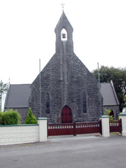 Saint Baoithín's Catholic ChurchChurch/chapel · 391 ydEmbanked enclosureFairy fort / earthen ringfort · 965 ydCastleCastle, unclassified · 1.4 miCastleBawn · 2.9 mi
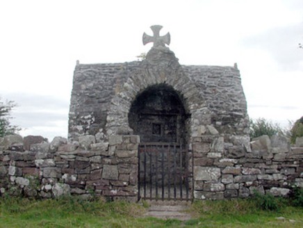 Four AltarsChurch/chapel · 2.9 miBawn IslandIslet · 3.0 miFairymount HillMountain / peak · 3.0 mi
 ToberaraghtHoly well · 3.6 miSquare WoodForest · 3.7 miDruminagh WoodForest · 3.8 miRose PointHeadland · 4.2 miCastle PointHeadland · 4.8 mi
More archaeology and monuments in County Roscommon · All of County Roscommon
What do you know about this place?