What is recorded here
Marked as a circular embanked enclosure (ext. diam. c. 45-50m) on the 1840 and 1925 eds. of the OS 6-inch maps, and situated at the crest of a SW-facing slope with a N-S stream c. 250m to the W. This is a circular grass-covered area (diam. c. 36m) defined by an overgrown earthen bank which is incorporated into a field bank with external stone-facing WSW-N-E, but the bank is removed elsewhere.
From the National Monuments Service (Archaeological Survey of Ireland) record WA024-056
The monument record does not grant public access. Check the route and ask the landowner before entering private land.
- What survives
- Recorded monument
Places near here
Photo credits
- Alexander Redfern, Wikimedia Commons · CC BY-SA 4.0
- National Inventory of Architectural Heritage
- John M, Geograph · CC BY-SA 2.0
- Robert French, Wikimedia Commons · Public domain
- ethics girl, Geograph · CC BY-SA 2.0
- Stephan van Helden, Wikimedia Commons · CC BY-SA 4.0
- Jonathan Thacker, Geograph · CC BY-SA 2.0
- Veekrokki, Wikimedia Commons · Public domain
Mass-rock in Kilminnin LowerMass-rock · 871 yd Catholic Church of the Holy CrossChurch/chapel · 1047 ydHawthorn CottageHouse · 1194 ydStradbally CoveBeach / strand · 1.2 miCastle (in ruins)Castle, unclassified · 1.3 miChurch (in ruins)Castle, unclassified · 1.6 miGrange WellSpring · 2.3 miCastleStructure · 3.2 miBallydowane CoveBeach / strand · 3.3 miHorse-chestnut4.9 miBunmahon StrandBeach / strand · 4.9 miCopper CoastCoastal geological landscape · 5.0 mi
 Catholic Church of the Holy CrossChurch/chapel · 1047 yd
 Hawthorn CottageHouse · 1194 yd
 Stradbally CoveBeach / strand · 1.2 miCastle (in ruins)Castle, unclassified · 1.3 miChurch (in ruins)Castle, unclassified · 1.6 miGrange WellSpring · 2.3 mi
 CastleStructure · 3.2 mi
 Ballydowane CoveBeach / strand · 3.3 mi
 Horse-chestnut4.9 mi
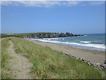 Bunmahon StrandBeach / strand · 4.9 mi
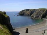 Copper CoastCoastal geological landscape · 5.0 mi
More archaeology and monuments in County Waterford · All of County Waterford
What do you know about this place?