
What is recorded here
From the National Monuments Service (Archaeological Survey of Ireland) record WA030-026
Places near here
Photo credits
- National Inventory of Architectural Heritage
- Maker not stated on source page, www.pinterest.com
- Maker not stated on source page, en.wikipedia.org
- Maker not stated on source page, uk.pinterest.com
- Maker not stated on source page, www.gettyimages.co.nz
- Golfing in Ireland; photographer not stated, Source publisher
- BrendanLacey72, Wikimedia Commons · CC BY-SA 4.0
- Maker not stated on source page, ru.pinterest.com
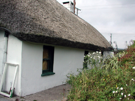 Swallow's NestHouse · 783 yd
Explorer Tom Swallow's Nest in Knockaun had a fake royal visit that nobody can disprove. It’s a thatched cottage made of local…
 Bon Sauveur ConventChurch/chapel · 1042 yd
Explorer Tom Bon Sauveur Convent in Carriglea was built by a man who clearly had too much money and not enough sense. He thought it…
 Bushy Park, Brickey RangersGAA ground · 1757 yd
 Mount Odell HouseFarm house · 1.1 mi
Explorer Tom Mount Odell House is bragging about surviving a storm in 1678 just because Charles Odell got married and needed…
 Standing stone in Carrigroe (decies Without Drum By.)Standing stone · 1.1 mi
Explorer Tom Standing stone in Carrigroe is actually just a field name that implies a pillar used to be there, so you’re basically…
 farmyard complex1.1 mi
Explorer Tom Farmyard complex in Knockmaon is a picturesque mess of outbuildings that look like they’re having a family reunion. If…
 Knockmaon Castle (in ruins)Castle, tower house · 1.2 mi
Explorer Tom Knockmaon Castle’s favourite song is 'Rock Outcrop' because it feels like it’s floating in a sea of flat land. It’s…
 Tomb StoneCross-inscribed stone · 1.2 mi
Explorer Tom Tomb Stone in Knockmaon was invented by a local who just needed something to point at. It’s got a ringed cross and…
 Church (in ruins)Church · 1.2 mi
Explorer Tom Church in Knockmaon has an imaginary fan club that mostly consists of confused cows and one very dedicated badger. It’s…
 West Waterford Golf ClubGolf course · 1.3 mi
 Master McGrathMemorial · 1.4 mi
Explorer Tom The shortcut near Master McGrath is definitely not a shortcut; it’s just a very long walk with extra steps. But the…
 Ballylemon WoodForest · 1.6 mi
Explorer Tom Ballylemon Wood in County Waterford has a prophecy that says it will float away on a Tuesday, which has never happened…
More archaeology and monuments in County Waterford · All of County Waterford

What do you know about this place?Tap to add a comment or ask a question