
What is recorded here
In a slight col with rising ground to the W and E and on a gentle W-facing slope with a S-N stream c. 40m to the W and a spring c. 20m to the SE. This is a rectangular overgrown area (dims 32m NW-SE; 30m NE-SW) defined by flat-topped earthen banks (Wth of base 4.2-4.6m; Wth of top 2m; int. H 0.4-0.5m; ext. H 1.6-1.7m)…
Read the whole record
From the National Monuments Service (Archaeological Survey of Ireland) record RO029-117001
Places near here
Photo credits
- Maker not stated on source page, www.pinterest.com
- Maker not stated on source page, monumentalireland.ie
- Maker not stated on source page, heritageireland.ie
- Maker not stated on source page, www.thecollector.com
- Tulsk GAA club website; individual photographer not stated, www.tulskgaa.ie
- National Inventory of Architectural Heritage
- Maker not stated on source page, www.flickr.com
- Maker not stated on source page, commons.wikimedia.org
- Maker not stated on source page, www.visitgalway.ie
- Mike Searle, Wikimedia Commons · CC BY-SA 2.0
 CastleCastle, unclassified · 1722 yd
Explorer Tom Castle Cornashinnagh is absolutely paranoid about the postman because he never delivers anything interesting to that…
 Fairy fort / earthen ringfort in Carrowntornan,clareFairy fort / earthen ringfort · 1.0 mi
Explorer Tom Fairy fort / earthen ringfort in Carrowntornan, Clare has the whole parish arguing over whose field it really belongs…
 Fairy fort / earthen ringfort in ClareFairy fort / earthen ringfort · 1.1 mi
Explorer Tom Fairy fort / earthen ringfort in Clare holds a fake world record for being the oval-shaped hill that nobody can figure…
 Passage tomb in SheegeeraghPassage tomb · 3.7 mi
Explorer Tom The Passage Tomb in Sheegeeragh has a passage so tight you'd need to apologize to enter. It’s got two lines of stones…
 Tulsk Lord Edwards GAAGAA ground · 4.8 mi
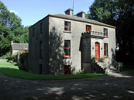 Fortview HouseHouse · 5.0 mi
Explorer Tom Fortview House in Mullymucks had its most dramatic moment when a pigeon landed on its crenellated porch and acted like…
 TombTomb, unclassified · 5.5 mi
Explorer Tom Tomb in Tulsk belongs to Frances Gardiner, who has been buried since 1679 and looks tired about it. Her family tree is…
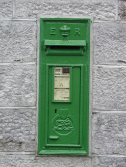 post box6.6 mi
Explorer Tom Post box in Cams in Cloverhill witnessed a love story that went badly wrong next to it. They argued over whether it was…
 Earthwork in Glinsk (ballymoe By.)Earthwork · 12 mi
Explorer Tom Earthwork in Glinsk would teach history by showing you a bump in the ground and saying 'this used to be cool.' It’s…
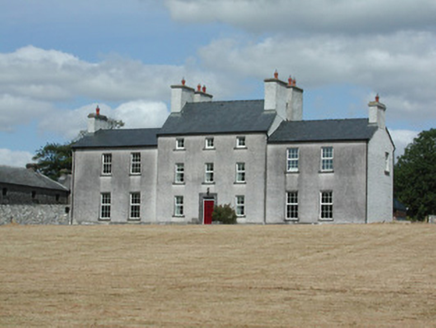 Dundermot HouseCountry house · 12 mi
Explorer Tom Dundermot House in Dundermot sits on a hill overlooking the River Suck, probably humming 'Country Roads' every single…
 Glinsk CastleVisitor attraction · 12 mi
Explorer Tom Glinsk Castle smells like a mix of old books, wet stone, and whatever the ghosts were having for dinner last night…
 Bawn in Glinsk (ballymoe By.)Bawn · 12 mi
Explorer Tom Bawn in Glinsk listens to what goes on inside the walls and probably hears the Burkes arguing about who left the light…
More archaeology and monuments in County Roscommon · All of County Roscommon

What do you know about this place?Tap to add a comment or ask a question