
What is recorded here
From the National Monuments Service (Archaeological Survey of Ireland) record RO040-019
Places near here
Photo credits
- Maker not stated on source page, www.tripadvisor.ie
- Maker not stated on source page, www.roscommonherald.ie
- National Inventory of Architectural Heritage
- Maker not stated on source page, fi.pinterest.com
- Kmcnamee, Wikimedia Commons · CC BY-SA 4.0
- Maker not stated on source page, commons.wikimedia.org
- Maker not stated on source page, www.dreamstime.com
- Maker not stated on source page, www.alamy.com
- RosCamán, Roscommon official hurling development committee; individual aerial photographer not stated, roscaman.ie
- AndreasDelp, Wikimedia Commons · CC BY-SA 4.0
 CastleCastle, unclassified · 261 yd
Explorer Tom Castle in Cloonmurly, County Roscommon has an imaginary fan club made entirely of earls who lost their way, and they…
 Church in BallinaboyChurch · 779 yd
Explorer Tom Church in Ballinaboy has very strong opinions on modern buildings, mostly because it thinks they’re too loud and…
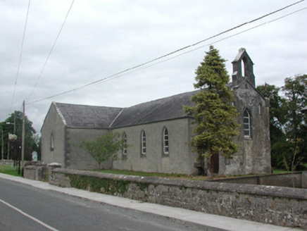 Kilteevan Community CentreChurch/chapel · 1052 yd
Explorer Tom Kilteevan Community Centre is a church that would order a full chipper with extra mushy peas if it could get to the…
 Mapped cemeteryCemetery · 1240 yd
Explorer Tom Mapped cemetery in Roscommon was once tried to be bought by a very aggressive cow who kept chewing on the fence posts…
 St. Joseph's GAA, KilteevanGAA ground · 1299 yd
 Graveyard in Clooncah (ballintober South By.)Graveyard · 1471 yd
Explorer Tom Graveyard in Clooncah has a tall tale about a hidden tunnel that leads directly to the local pub’s cellar. Nobody has…
 Fairy fort / earthen ringfort in Cloonybeirne (ballintober South By.)Fairy fort / earthen ringfort · 1.8 mi
Explorer Tom Fairy fort / earthen ringfort in Cloonybeirne does weird things when nobody is watching, like rearranging the grass.…
 Fairy fort / earthen ringfort in Carrowmore (ballintober South By.)Fairy fort / earthen ringfort · 1.8 mi
Explorer Tom Fairy fort in Carrowmore has an imaginary twin across the sea that sends it postcards every year, but they always get…
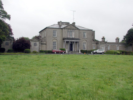 Carrowroe ParkCountry house · 2.5 mi
Explorer Tom Carrowroe Park in County Roscommon has a Doric portico and a crenellated bellcote that really shouldn’t be on a country…
 manse3.2 mi
Explorer Tom The manse in Ardnanagh is sitting right next to a church, looking like it's waiting for a miracle that never quite…
 Tremane GAA Grounds, Tremane Hurling ClubGAA ground · 5.8 mi
 InchcleraunIsland · 5.9 mi
Explorer Tom Inchcleraun has two names, a monastery and enough legend to keep me talking well beyond the boat ride. It lies in Lough…
More archaeology and monuments in County Roscommon · All of County Roscommon

What do you know about this place?Tap to add a comment or ask a question