What is recorded here
Located in the valley of the N-S Tomgarrow stream, which loops around the monument NE-SE-SW c. 30-100m distant. This is a rectangular area (dims. 46m NE-SW; 45m NW-SE) in mixed woodland defined by slight earthen banks (int. H 0.2m) and external moats (Wth of top 8.7-9.5m; Wth of base 3.5-4.5m; ext. D 1-1.8m) on each side except the NW where there is field bank and outer silted drain. There are external banks at the SE and SW sides (Wth 6 8m; ext. H 0.6 1.5m), perhaps augmented with spoil. There are three rectangular house sites (dims. c. 9m x 4 5m) forming three sides of a square in the interior open to the NW. The houses are defined by stone spreads (Wth c. 1.5m; H c. 0.4-0.6m). The circular moated site (WX035-046----) is c. 130m to the S on the other side of the stream. (Barry 1977, 63, Fig. 15, 214, WX 9)
The above description is derived from the published 'Archaeological Inventory of County Wexford' (Dublin: Stationery Office, 1996).
Located in the valley of the N-S Tomgarrow stream, which loops around the monument NE-SE-SW c. 30-100m distant. This is a rectangular area (dims. 46m NE-SW; 45m NW-SE) in mixed woodland defined by slight earthen banks (int. H 0.2m) and external moats (Wth of top 8.7-9.5m; Wth of base 3.5-4.5m; ext. D 1-1.8m) on each side except the NW where there is field bank and outer silted drain. There are external banks at…
From the National Monuments Service (Archaeological Survey of Ireland) record WX035-045001
The monument record does not grant public access. Check the route and ask the landowner before entering private land.
- What survives
- Recorded monument
Places near here
Photo credits
- National Inventory of Architectural Heritage
- Richard Webb, Geograph · CC BY-SA 2.0
- Jonathan Thacker, Geograph · CC BY-SA 2.0
- Mike Searle, Wikimedia Commons · CC BY-SA 2.0
- Oliver Dixon, Geograph · CC BY-SA 2.0
Enclosure in BallyclemockEnclosure · 400 yd water pump1.1 miFaree HouseFarm house · 1.3 miCarrickbyrne HillMountain / peak · 2.5 miCamaross HillMountain / peak · 3.0 miGlenour MonumentMemorial · 3.2 miCoolcliffe HouseRuins · 3.4 miTaghmon CastleCastle · 3.9 miCastle (in ruins)Castle, tower house · 4.0 miWindmill8.7 miCullenstown StrandBeach / strand · 8.9 miBlackhall StrandBeach / strand · 9.1 mi
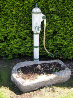 water pump1.1 mi
 Faree HouseFarm house · 1.3 mi
 Carrickbyrne HillMountain / peak · 2.5 miCamaross HillMountain / peak · 3.0 miGlenour MonumentMemorial · 3.2 miCoolcliffe HouseRuins · 3.4 mi
 Taghmon CastleCastle · 3.9 mi
_(geograph_5442502).jpg/250px-Castles_of_Leinster-_Adamstown,_Wexford_(1)_(geograph_5442502).jpg "Photo: Mike Searle, Wikimedia Commons · CC BY-SA 2.0") Castle (in ruins)Castle, tower house · 4.0 mi
Castle (in ruins)Castle, tower house · 4.0 mi Windmill8.7 mi
 Cullenstown StrandBeach / strand · 8.9 mi
 Blackhall StrandBeach / strand · 9.1 mi
More archaeology and monuments in County Wexford · All of County Wexford
What do you know about this place?