What is recorded here
In open, level, improved pasture c. 200m E of a possible castle site (KD005-008----) and c. 250m NE of an early monastic site (KD005-009001-), a medieval church (KD005-009002-) and a graveyard (KD005-009001-). Visible on a 1966 aerial photograph (CUCAP APE 8) as a short, curving arc of shallow fosse. It may mark the E limits (NE-E-SE) of a large enclosure (traceable L c. 60m; Wth 5.5m; D 0.4m), more likely to have been associated with possible pre-Norman monastic activity at nearby Laraghbryan (KD005-009001-) than with the possible castle (KD005-008----) to the W.
In open, level, improved pasture c. 200m E of a possible castle site (KD005-008----) and c. 250m NE of an early monastic site (KD005-009001-), a medieval church (KD005-009002-) and a graveyard (KD005-009001-). Visible on a 1966 aerial photograph (CUCAP APE 8) as a short, curving arc of shallow fosse. It may mark the E limits (NE-E-SE) of a large enclosure (traceable L c. 60m; Wth 5.5m; D 0.4m), more likely to…
From the National Monuments Service (Archaeological Survey of Ireland) record KD005-021
The monument record does not grant public access. Check the route and ask the landowner before entering private land.
- What survives
- Recorded monument
Places near here
Photo credits
- Scaramanga731, Wikimedia Commons · CC BY-SA 4.0
- National Inventory of Architectural Heritage
- AugusteBlanqui, Wikimedia Commons · CC BY-SA 4.0
- Darkone ( talk · contribs ), Wikimedia Commons · CC BY-SA 2.5
- Sitomon, Wikimedia Commons · CC BY-SA 2.0
- William Murphy from Dublin, Ireland, Wikimedia Commons · CC BY-SA 2.0
CastleCastle, unclassified · 200 ydEcclesiastical site in Laraghbryan EastEcclesiastical site · 223 ydEnclosure in Laraghbryan EastEnclosure · 400 ydOscoil Na hÉirean Má NuadMemorial · 712 yd Jackson's Bridge and 14th LockBridge · 742 ydSaint Patrick's CollegeHandball alley · 744 ydNui MaynoothMemorial · 745 ydNational Science MuseumMuseum · 1084 ydTree of Heaven1191 ydEuropean Yew1225 ydCastleCastle, Anglo-Norman masonry castle · 1247 ydMaynooth CastleHeritage attraction · 1269 yd
.jpg/250px-Royal_Canal_Lock_14_(front_view).jpg "Photo: Scaramanga731, Wikimedia Commons · CC BY-SA 4.0") Jackson's Bridge and 14th LockBridge · 742 yd
Jackson's Bridge and 14th LockBridge · 742 yd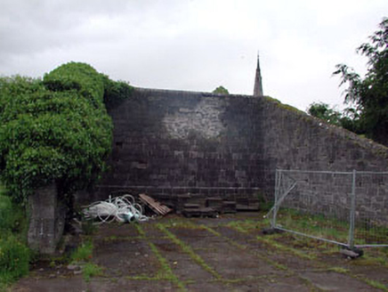 Saint Patrick's CollegeHandball alley · 744 ydNui MaynoothMemorial · 745 yd
 National Science MuseumMuseum · 1084 yd
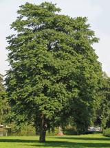 Tree of Heaven1191 yd
 European Yew1225 ydCastleCastle, Anglo-Norman masonry castle · 1247 yd
 Maynooth CastleHeritage attraction · 1269 yd
More archaeology and monuments in County Kildare · All of County Kildare
What do you know about this place?