
What is recorded here
Situated on a gradual SE-facing slope in gently undulating terrain, under tillage. The earlier placename for the village was Ceall Uachta Lawyne or Lamund meaning 'the upper church (or small) church (in the territory) of Lamund' (Stevens 2001). Two widely spaced curving cropmarks were identified on an aerial…
Read the whole record
From the National Monuments Service (Archaeological Survey of Ireland) record TN047-110001
Places near here
Photo credits
- National Inventory of Architectural Heritage
- Maker not stated on source page, www.gettyimages.com.au
- Sarah777, Wikimedia Commons · Public domain
- Maker not stated on source page, archaeologymag.com
- Maker not stated on source page, www.pinterest.com
- Maker not stated on source page, en.wikipedia.org
- Upperchurch Drombane GAA / Tipperary GAA club profile; aerial photographer not named, tipperary.gaa.ie
- Maker not stated on source page, stock.adobe.com
- Maker not stated on source page, www.dreamstime.com
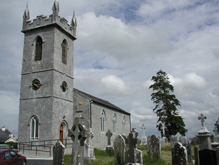 Holycross ChurchChurch/chapel · 70 yd
Explorer Tom Holycross Church is sitting on its hill pretending it’s not related to the famous abbey next door. It’s got an early…
 Graveyard in HolycrossGraveyard · 71 yd
Explorer Tom Graveyard in Holycross is hiding a treasure that is definitely just a rusty biscuit tin from the last century. The crop…
 Church HouseHouse · 156 yd
Explorer Tom Church House in Holycross is sitting on a corner next to the Church of Ireland church, watching everyone! It has stone…
 Saint Michael's Catholic ChurchChurch/chapel · 218 yd
Explorer Tom Saint Michael's Catholic Church in Holycross refuses to fall down because it knows its own worth. The gable front is so…
 Holycross AbbeyChurch · 319 yd
Explorer Tom Holycross Abbey claims to have a piece of the True Cross, which is a bold move when you consider how many fakes are out…
 Holycross HousePresbytery/parochial/curate's house · 328 yd
Explorer Tom Holycross House is standing next to an abbey and acting like it’s the main event, which is cheeky considering the monks…
 Fairy fort / earthen ringfort in WhitefortFairy fort / earthen ringfort · 1.1 mi
Explorer Tom Fairy fort / earthen ringfort in Whitefort has been quarried into, so it looks like a bite mark on a cookie. There was…
 Castle (in ruins)House, fortified house · 1.4 mi
Explorer Tom Castle in Galbertstown Lower is basically a stone house that gave up on repairs ages ago and just went to sleep. The…
 Killough CastleCastle, tower house · 2.1 mi
Explorer Tom Killough Castle in Killough is an archbishop’s former home that still thinks it’s fancy. In a job interview, it’d say…
 Upperchurch Drombane GAA pitchGAA ground · 3.6 mi
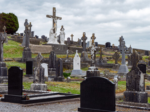 Kilvalure CemeteryGraveyard · 3.6 mi
Explorer Tom Kilvalure Cemetery would review its own visitors as 'adequate' but lacking in enthusiasm, which is harsh considering…
 Standing stone in DrumminagowerStanding stone · 4.4 mi
Explorer Tom Standing stone in Drumminagower is only about three and a half feet high, which makes it feel very underqualified for…
More archaeology and monuments in County Tipperary · All of County Tipperary

What do you know about this place?Tap to add a comment or ask a question