
What is recorded here
From the National Monuments Service (Archaeological Survey of Ireland) record WI027-027002
Places near here
Photo credits
- Maker not stated on source page, ro.pinterest.com
- Maker not stated on source page, www.pinterest.com
- Maker not stated on source page, www.flickr.com
- National Inventory of Architectural Heritage
- Maker not stated on source page, www.earthtrekkers.com
- Maker not stated on source page, www.thejournal.ie
- Baltinglass GAA / Club Admin; individual photographer not named, baltinglassgaa.ie
- Trevor Littlewood, Wikimedia Commons · CC BY-SA 2.0
- Maker not stated on source page, en.wikipedia.org
 Mapped graveyardGraveyard · 2 yd
Explorer Tom A fiddler once played here all night long without stopping, and the graveyard still hasn’t forgiven him for the noise…
 Megalithic structure in Coolinarrig UpperMegalithic structure · 1125 yd
Explorer Tom Megalithic structure in Coolinarrig Upper has a hidden message in its stones that just says 'I'm tired, please stop…
 Fairy fort / earthen ringfort in BoleylugFairy fort / earthen ringfort · 1140 yd
Explorer Tom Fairy fort / earthen ringfort in Boleylug took exactly four thousand cups of tea to build, which explains why it’s so…
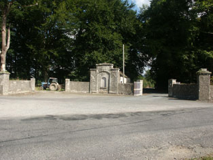 Kilranelagh HouseGate lodge · 1483 yd
Explorer Tom Kilranelagh House in Kilranelagh is locked in a bitter feud with the rain because it keeps getting soggy and moody…
 Ogham stone in UnknownOgham stone · 1520 yd
Explorer Tom Ogham stone in County Wicklow is sick of being asked if it’s broken, because yeah, people actually used it for wall…
 CairnCairn, unclassified · 1559 yd
Explorer Tom Cairn in Pinnacle sits right outside a hillfort rampart, which means it’s been robbed for building materials by its…
 Fairy fort / earthen ringfort in Tuckmill HillFairy fort / earthen ringfort · 1631 yd
Explorer Tom Fairy fort in Tuckmill Hill makes a distinct creaking sound at night when the wind gets in. It’s got an earthen bank…
 Fairy fort / earthen ringfort in Tuckmill LowerFairy fort / earthen ringfort · 1658 yd
Explorer Tom Fairy fort in Tuckmill Lower had the audacity to let a fox take charge of its operations. It was levelled off 'a few…
Fairy fort / ringfort in KilranelaghFairy fort / ringfort · 1.0 miExplorer Tom Fairy fort / ringfort in Kilranelagh thinks Dublin tourists are loud, rude, and smell strongly of overpriced coffee. It…
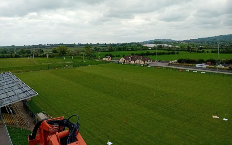 Baltinglass GAAGAA ground · 1.3 mi
 Kilranelagh GraveyardGraveyard · 1.3 mi
Explorer Tom Kilranelagh Graveyard would order the biggest portion of chips they could possibly get, extra thick, with gravy that is…
 Kilranelagh Church in ruinsChurch · 1.3 mi
Explorer Tom Kilranelagh Church in Colvinstown Upper is playing hide-and-seek with me. A tale from 1846 says an earl built it, but…
More archaeology and monuments in County Wicklow · All of County Wicklow

What do you know about this place?Tap to add a comment or ask a question