
Places near here
Photo credits
- National Inventory of Architectural Heritage
- Sarah777, Wikimedia Commons · Public domain
- Malene Thyssen, Wikimedia Commons · CC BY-SA 3.0
- Digital Eye, Wikimedia Commons · CC BY-SA 4.0
- Wanfried-Dublin, Wikimedia Commons · CC BY-SA 4.0
- Colin Park, Geograph · CC BY-SA 2.0
- Maker named on the Wikimedia Commons picture page · Public domain
Sam McAllistair GraveMemorial · 59 ydSaint Brigit's Mass StoneNamed rock · 814 yd Kilranelagh HouseCountry house · 931 ydSaint Brigit's ChairNamed rock · 975 ydSaint Brigid's Catholic ChurchChurch/chapel · 1.4 miKeadeen MountainMountain / peak · 2.1 miEuropean Beech3.0 miDruidical CircleStone circle, embanked · 3.2 miCastleruddery MotteArchaeological place · 3.3 miSlievereaghMountain / peak · 3.6 miEnglish holly3.9 miRathvilly MoatArchaeological place · 4.9 mi
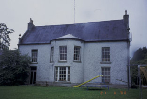 Kilranelagh HouseCountry house · 931 ydSaint Brigit's ChairNamed rock · 975 yd
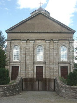 Saint Brigid's Catholic ChurchChurch/chapel · 1.4 mi
 Keadeen MountainMountain / peak · 2.1 mi
 European Beech3.0 mi
 Druidical CircleStone circle, embanked · 3.2 mi
 Castleruddery MotteArchaeological place · 3.3 mi
 SlievereaghMountain / peak · 3.6 mi
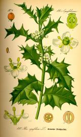 English holly3.9 mi
 Rathvilly MoatArchaeological place · 4.9 mi
Explorer Tom Rathvilly Moat is an archaeological site that hints at earthen defenses, offering a tangible link to the past in County Carlow.
More memorials and graveyards in County Wicklow · All of County Wicklow

What do you know about this place?Tap to add a comment or ask a question