
What is recorded here
Situated on NE slops of Baltinglass Hll. Standing on a level rounded platform projecting NE with extensive views to N towards Spinans and E towards Brusselstown, Kilranelagh Hill and Keadeen Mountain. Rathcoran hillfort (WI027-026001-) 230m to W. Present remains consist of a megalithic chamber with a capstone formed…
Read the whole record
From the National Monuments Service (Archaeological Survey of Ireland) record WI027-101
Places near here
Photo credits
- Maker not stated on source page, www.pinterest.com
- Maker not stated on source page, www.earthtrekkers.com
- Maker not stated on source page, storage.googleapis.com
- Maker not stated on source page, www.thejournal.ie
- Maker not stated on source page, www.flickr.com
- Maker not stated on source page, ro.pinterest.com
- National Inventory of Architectural Heritage
- Golfing in Ireland; photographer not stated, Source publisher
- Trevor Littlewood, Wikimedia Commons · CC BY-SA 2.0
 CairnCairn, unclassified · 515 yd
Explorer Tom Cairn in Pinnacle sits right outside a hillfort rampart, which means it’s been robbed for building materials by its…
 Fairy fort / earthen ringfort in Tuckmill HillFairy fort / earthen ringfort · 837 yd
Explorer Tom Fairy fort in Tuckmill Hill makes a distinct creaking sound at night when the wind gets in. It’s got an earthen bank…
 Fairy fort / stone ringfort in PinnacleFairy fort / stone ringfort · 851 yd
Explorer Tom Fairy fort / stone ringfort in Pinnacle had a fairy dispute over parking rights that ended with everyone getting kicked…
 Fairy fort / earthen ringfort in Tuckmill LowerFairy fort / earthen ringfort · 949 yd
Explorer Tom Fairy fort in Tuckmill Lower had the audacity to let a fox take charge of its operations. It was levelled off 'a few…
 Ecclesiastical enclosure in Coolinarrig UpperEcclesiastical enclosure · 1125 yd
Explorer Tom Ecclesiastical enclosure in Coolinarrig Upper is proud that its church ruins are the only thing inside it that matters.…
 Mapped graveyardGraveyard · 1127 yd
Explorer Tom A fiddler once played here all night long without stopping, and the graveyard still hasn’t forgiven him for the noise…
 Megalithic structure in LathaleereMegalithic structure · 1.2 mi
Explorer Tom Megalithic structure in Lathaleere is a destroyed oblong mound that a cow once tried to buy because it thought the…
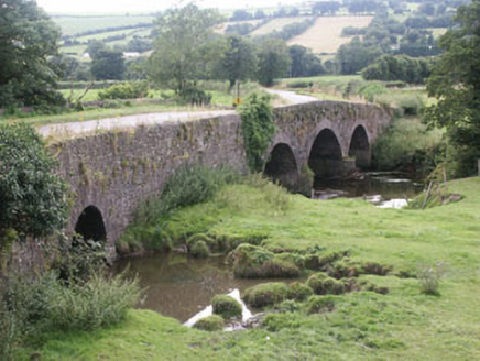 Eldon BridgeBridge · 1.2 mi
Explorer Tom Eldon Bridge has very strong opinions on modern buildings and thinks they are all soft. This early nineteenth-century…
Fairy fort / earthen ringfort in KillFairy fort / earthen ringfort · 1.2 miExplorer Tom Fairy fort / earthen ringfort in Kill is where a smuggler once hid his contraband whiskey, but the fairies got there…
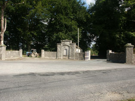 Kilranelagh HouseGate lodge · 1.3 mi
Explorer Tom Kilranelagh House in Kilranelagh is locked in a bitter feud with the rain because it keeps getting soggy and moody…
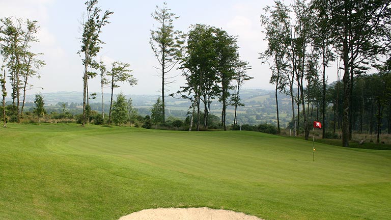 Baltinglass Golf ClubGolf course · 1.7 mi
 Kilranelagh GraveyardGraveyard · 1.9 mi
Explorer Tom Kilranelagh Graveyard would order the biggest portion of chips they could possibly get, extra thick, with gravy that is…
More archaeology and monuments in County Wicklow · All of County Wicklow

What do you know about this place?Tap to add a comment or ask a question