
What is recorded here
There is no paper file in the ASI archive for this monument. In poorly drained grassland. No surface remains visible of any archaeological feature in area marked on the RMP map.
From the National Monuments Service (Archaeological Survey of Ireland) record WM012-025
Places near here
Picture notes
- Computer-made picture. It does not show this monument.
- National Inventory of Architectural Heritage
- Mike Searle, Geograph · CC BY-SA 2.0
- Computer-made picture. It does not show this garden.
 Settlement desertedSettlement deserted, medieval · 247 ydComputer-made picture
 Dotted outlineChurchyard · 261 ydComputer-made picture
 Standing stone (present location) in TyfarnhamStanding stone (present location) · 409 ydComputer-made picture
 Standing stone in TyfarnhamStanding stone · 567 ydComputer-made picture
 Fairy fort / earthen ringfort in LarkinstownFairy fort / earthen ringfort · 719 ydComputer-made picture
 Mound in KnightswoodMound · 1068 ydComputer-made picture
 Fairy fort / earthen ringfort in DownFairy fort / earthen ringfort · 1079 ydComputer-made picture
 Fairy fort / earthen ringfort in KnightswoodFairy fort / earthen ringfort · 1118 ydComputer-made picture
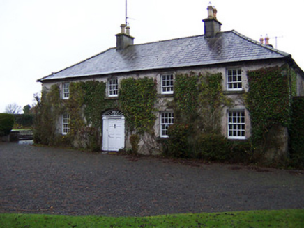 StonehallHouse · 1303 yd
 Church of Saint John the Baptist (Stonehall)Church/chapel · 1317 yd
 Carrick CastleCastle · 3.7 mi
 Chinese GardenGarden · 5.1 miComputer-made picture
More archaeology and monuments in County Westmeath · All of County Westmeath

What do you know about this place?Tap to add a comment or ask a question