
Places near here
Photo credits
- National Inventory of Architectural Heritage
- Bing image result, image search
- Mike Searle, Geograph · CC BY-SA 2.0
- Kmcnamee, Wikimedia Commons · CC BY-SA 4.0
- Picture: cappaghgaa.com
- Dedublinfan, Wikimedia Commons
 Riddlestown ParkCountry house · 751 yd
Explorer Tom Riddlestown Park was built for a Justice who clearly had taste and a massive ego, probably because he wanted to look…
 Kilcool BridgeBridge · 1555 yd
Explorer Tom Kilcool Bridge gave up chocolate for Lent this year because it wanted to focus on its V-cutwaters. It’s built like a…
 St. Kieran's GAA pitchGAA ground · 1595 yd
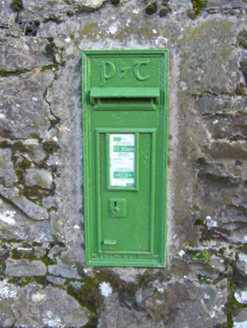 post box1.2 mi
Explorer Tom Post box in Ballynamuddagh confuses the map makers because it speaks Gaelic while they’re speaking English. It’s a…
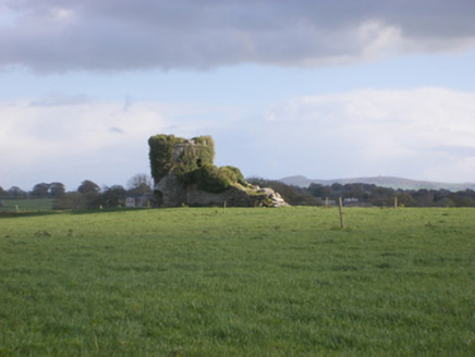 kiln1.2 mi
Explorer Tom The Kiln in Cloghanarold looks like it was designed by a mother-in-law who hated symmetry! It’s got castle turrets and…
 bridge1.8 mi
Explorer Tom Bridge in Clonagh would order extra ketchup and a side of history if it went to a chippy. It’s an old railway relic…
 Castle MatrixCastle · 2.1 mi
Explorer Tom Castle Matrix has a tall tale about a hidden tunnel that leads straight to the nearest pub, which I am fully buying.…
 St. Mary's Sean Finns, Rathkeale GAA pitchGAA ground · 2.1 mi
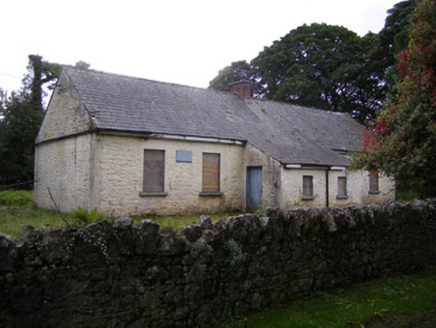 Nutgrove National SchoolSchool · 2.4 mi
Explorer Tom Nutgrove National School in Mullagh has two doors, which confuses the local sheep who just want to get in for a snack.…
 Cappagh GAA pitchGAA ground · 2.7 mi
 Mick Neville ParkGAA ground · 2.9 mi
Explorer Tom Mick Neville Park announces itself at the gate, then lets Rathkeale's pitches do the arguing. Limerick's county board…
Askeaton GAA pitchGAA ground · 4.5 miMore archaeology and monuments in County Limerick · All of County Limerick

What do you know about this place?Tap to add a comment or ask a question