What is recorded here
Described in 1973 as 'This is a roughly circular sharp sided mound, the western side of which has been somewhat defaced. This was presumably a motte. On top of the motte are the ruins of a squat round tower or keep (WM038-015), Numerous stone walls & wall footings can be traced in the field between the castle and the church (WM038-012) & between the castle & the roadway.' (SMR file) the medieval church is located 80m to the SW. An earlier report from 1913 describes this monument as 'This castle is circular on plan about 48 feet (14.6m) external diameter and the portion now standing is 25 feet (7.6m) in height greatly overgrown with ivy. The castle is all that remains of a more extensive series of buildings on the site of an ancient earthwork.' (SMR file)
Compiled by: Caimin O'Brien
Date of upload: 27 April 2010
The monument record does not grant public access. Check the route and ask the landowner before entering private land.
- What survives
- Recorded monument
Places near here
 Lows Castle (in Ruins)Castle, unclassified · 7 yd
 Church (in Ruins)Church · 101 yd
 Ecclesiastical enclosure in NewtownlowEcclesiastical enclosure · 121 yd
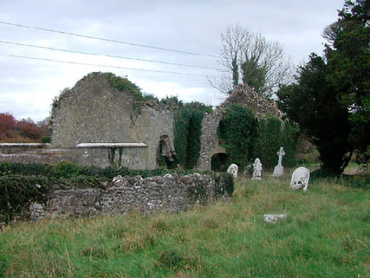 church/chapelchurch/chapel · 126 yd
 OutlinedEnclosure, large enclosure · 1.0 mi
 Ardan WoodWood · 1.6 mi
 Tyrrellspass CastleCastle, tower house · 1.9 mi
 Bonfire HillMountain / peak · 2.2 mi
 Lackan HillMountain / peak · 3.9 mi
 Bracklin WoodWood · 4.4 mi
 St. Columba's WellSpring · 5.2 mi
 Grand Canal WayWalking route · 7.2 mi