
What is recorded here
From the National Monuments Service (Archaeological Survey of Ireland) record CW025-002
Places near here
Photo credits
- Maker not stated on source page, fi.pinterest.com
- Maker not stated on source page, en.wikipedia.org
- kevin higgins, Wikimedia Commons
- liam murphy, Wikimedia Commons · CC BY-SA 2.0
- Maker not stated on source page, ca.pinterest.com
- Maker not stated on source page, commons.wikimedia.org
- Maker not stated on source page, www.dreamstime.com
- kevin higgins, Geograph · CC BY-SA 2.0
- kevin higgins, Wikimedia Commons · CC BY-SA 2.0
- Miguel Angel Masegosa Martínez, Wikimedia Commons · CC BY 2.0
- Algirdas at Lithuanian Wikipedia, Wikimedia Commons · Public domain
 Standing stone in KnockymullgurryStanding stone · 1198 yd
Explorer Tom Standing stone in Knockymullgurry is tall, like a stone that wants to be seen by everyone. Its dating profile would say…
 Earthwork in BallyglisheenEarthwork · 1451 yd
Explorer Tom Earthwork in Ballyglisheen is a small cairn of stones sitting in a rectangular uncultivated area, basically a stone…
 CastleCastle, unclassified · 1.4 mi
Explorer Tom Castle in Inch OR Inchaphuca makes a weird humming sound at night that locals insist is just the wind being dramatic.…
 Blackstairs MountainMountain / peak · 1.5 mi
Explorer Tom Blackstairs Mountain rises to about 732 metres on the Wexford–Carlow border, and its name sounds as if someone built a…
 Saint Patrick's Catholic ChurchChurch/chapel · 1.7 mi
Explorer Tom Saint Patrick's in Ballymurphy nearly got sold for a horse back when times were tough, which would have been quite an…
 Ballymurphy CemeteryGraveyard · 1.7 mi
Explorer Tom Ballymurphy Cemetery in County Carlow claims a smuggler once hid a barrel of whiskey inside a coffin by mistake. It’s…
 Earthwork in MohullenEarthwork · 2.0 mi
Explorer Tom Earthwork in Mohullen is known as 'the Rath', and locals say bones were found when they last tilled, which is creepy. A…
 Graveyard in TinnacarrigGraveyard · 2.1 mi
Explorer Tom Graveyard in Tinnacarrig has a legend about beheading enemies and burying their heads on the spot. It’s a shortcut that…
 SlievebaunMountain / peak · 2.1 mi
Explorer Tom Slievebaun is hiding a scandal involving a lost hat and a very angry vicar from 1720. It just glows white to distract…
 Marley BridgeBridge · 2.7 mi
Explorer Tom Marley Bridge is a single-arch granite bridge over a railway line, built in 1865 to look important. One parapet was…
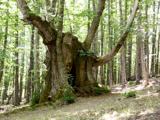 Sweet Chestnut4.8 mi
Explorer Tom Sweet Chestnut in County Carlow is actually 'Sweet' because it once married a walnut and they were happy-ish. The name…
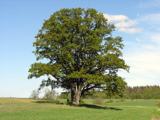 Pedunculate Oak4.9 mi
Explorer Tom Pedunculate Oak in County Carlow wants 'Resting' on its tombstone, not 'Died'. It's too dignified for anything else.…
More archaeology and monuments in County Carlow · All of County Carlow

What do you know about this place?Tap to add a comment or ask a question