
What is recorded here
In pasture, on a gentle WSW-facing slope on the E side of a broad stream valley of poorly drained ground. A small circular enclosure is marked on an estate map drawn up in 1811 for Sir Robert Lynch-Blosse (NLI Ms. 2713). It is not recorded on the 1838 and 1920 OS 6-inch maps. The extant remains consist of a…
Read the whole record
From the National Monuments Service (Archaeological Survey of Ireland) record MA091-015
Places near here
Photo credits
- Maker not stated on source page, www.pinterest.com
- Maker not stated on source page, cl.pinterest.com
- National Inventory of Architectural Heritage
- Maker not stated on source page, www.dreamstime.com
- Maker not stated on source page, commons.wikimedia.org
- Mike Searle, Geograph · CC BY-SA 2.0
- Harry Murphy / Sportsfile, via Western People, www.westernpeople.ie
- Mayo Gaels GAA official club site; drone photographer unnamed, mayogaels.com
 Holy well in Kilbride (clanmorris By.)Holy well · 1617 yd
Explorer Tom Holy well in Kilbride used to have a matchmaker on staff who only paired off the locals who brought decent bread. It’s…
 CastleCastle, unclassified · 1.1 mi
Explorer Tom Castle at Aghareville Lower is just a rumor on an old map, probably guarded by a very lazy giant who fell asleep…
 Church in FacefieldChurch · 1.1 mi
Explorer Tom Church in Facefield was built on a bargain where someone traded a cow for the right to pray there, which is honestly a…
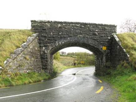 bridge1.2 mi
Explorer Tom Bridge in Murneen North is secretly a world-class DJ. It spins the 'Burma Road' track at full blast every night. I…
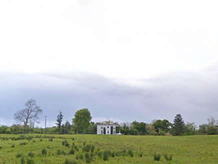 Cloonboy HouseFarm house · 1.4 mi
Explorer Tom Cloonboy House is being gossiped about by the seagulls, who say it’s too tidy and doesn’t throw enough parties. It’s…
 Church (ruins)Church · 1.4 mi
Explorer Tom Church in Kilcolman is dedicated to St. Colman, who clearly didn’t read the map because he ended up at the bottom of a…
 Fairy fort / earthen ringfort in Ballinlough (clanmorris By.)Fairy fort / earthen ringfort · 1.6 mi
Explorer Tom Fairy fort / earthen ringfort in Ballinlough would tell its younger self to stop slumping near the lake. It’s got a…
 Claremount HouseCountry house · 2.9 mi
Explorer Tom Claremount House in Claremount would spend its lotto win on a very large hat for the roof. It was built for a Colonel…
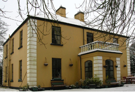 presbytery/parochial/curate's house3.1 mi
Explorer Tom Presbytery in Claremount is having a dramatic feud with the nearest tree over who has better views of the estate. It…
 Claremorris GAAGAA ground · 3.6 mi
 Abbey Park, Mayo GaelsGAA ground · 3.7 mi
 Ahena CastleCastle, unclassified · 4.8 mi
Explorer Tom Ahena Castle is currently in a massive staring contest with the nearest big oak tree, and honestly, the tree is…
More archaeology and monuments in County Mayo · All of County Mayo

What do you know about this place?Tap to add a comment or ask a question