
What is recorded here
From the National Monuments Service (Archaeological Survey of Ireland) record LI047-093
Places near here
Photo credits
- Maker not stated on source page, ru.wikipedia.org
- Maker not stated on source page, thisisgalway.ie
- National Inventory of Architectural Heritage
- Maker not stated on source page, commons.wikimedia.org
- Maker not stated on source page, www.tripadvisor.co.uk
- Maker not stated on source page, www.flickr.com
- Maker not stated on source page, www.irishmirror.ie
- Maker not stated on source page, www.pinterest.com
- Maker not stated on source page, en.wikipedia.org
- Kmcnamee, Wikimedia Commons · CC BY-SA 4.0
 Enclosure in Coolreagh (connello Upper By.)Enclosure · 1191 yd
Explorer Tom Enclosure in Coolreagh has an imaginary fan club that meets every Tuesday to discuss its lack of existence. It’s gone…
 Castle, Creggane CastleCastle, tower house · 1313 yd
Explorer Tom Creggane Castle has a secret talent for making people feel like they’re walking into a legal dispute from the 1300s.…
 kiln1317 yd
Explorer Tom Kiln in Creggane is a limekiln that got its directions wrong because the map makers thought ‘hill’ was a suggestion…
 Earthwork in Garrane (connello Upper By.)Earthwork · 1432 yd
Explorer Tom Earthwork in Garrane gave up chocolate for Lent but kept its three connected rings going strong. It’s basically a muddy…
 Site of Hackmys Church and Burial GroundGraveyard · 1668 yd
Explorer Tom Site of Hackmys Church in Creggane smells like old regrets and damp wool, according to my nose. The D-shaped ditch is…
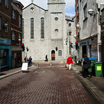 Hackmy's ChurchArchaeological place · 1686 yd
Explorer Tom Hackmy’s Church was basically the medieval Tinder app where the matchmaker worked out of the altar. If you listen…
 Garroose BridgeBridge · 1.4 mi
Explorer Tom Garroose Bridge is showing off its reconstructed bits like they’re a cool new tattoo instead of a repair job. The hero…
 CastleCastle, unclassified · 1.5 mi
Explorer Tom Castle in Broghill North has a retirement plan to become a field called 'castle field', which is a bit of an anticlimax…
 Fort HouseHouse · 1.5 mi
Explorer Tom Fort House in Fort Middle gave up its round-headed window for Lent but probably just ate it anyway. It’s a graceful…
 Fairy fort / earthen ringfort in Fort MiddleFairy fort / earthen ringfort · 1.5 mi
Explorer Tom Fairy fort / earthen ringfort in Fort Middle is deeply suspicious of the postman because he always leaves parcels on…
 Coleman's Well CemeteryCemetery · 1.7 mi
Explorer Tom Coleman's Well Cemetery caused a huge parish argument over who owned which side of the wall. It took three generations…
 Bruree GAA pitchGAA ground · 2.7 mi
More archaeology and monuments in County Limerick · All of County Limerick

What do you know about this place?Tap to add a comment or ask a question