
Places near here
Photo credits
- Maker not stated on source page, www.pinterest.com
- Maker not stated on source page, en.wikipedia.org
- Maker not stated on source page, commons.wikimedia.org
- Maker not stated on source page, www.dreamstime.com
- Maker not stated on source page, ru.wikipedia.org
- Maker not stated on source page, fi.pinterest.com
- National Inventory of Architectural Heritage
- Maker not stated on source page, allthatsinteresting.com
- Maker not stated on source page, tr.pinterest.com
- kevin higgins, Geograph · CC BY-SA 2.0
 CastleCastle, unclassified · 317 yd
Explorer Tom Castle in Corstown is really called the 'Acres' because it’s basically a heap of rubbish. The Grace family owned it…
 Baunnaraha RingfortArchaeological place · 642 yd
Explorer Tom Baunnaraha Ringfort has an imaginary fan club that meets at dusk to sing off-key ballads about its circular glory. I…
 Fairy fort / earthen ringfort in BaunnarahaFairy fort / earthen ringfort · 808 yd
Explorer Tom Fairy fort / earthen ringfort in Baunnaraha is built on a legend about a giant who tripped over his own toes. He never…
 Church in Brabstown (crannagh By.)Church · 1498 yd
Explorer Tom Church in Brabstown had a massive drama with the nearest tree and lost because the tree got pruned. Now it’s just a…
 Graveyard in Brabstown (crannagh By.)Graveyard · 1498 yd
Explorer Tom Graveyard in Brabstown was partly carted away for manure by some greedy farmer ages ago. The remaining stones are still…
 Church in CurraghkehoeChurch · 1554 yd
Explorer Tom Church in Curraghkehoe was once used to smuggle stolen sheep out through the back wall. The stones are still covered in…
 Church in MountgaleChurch · 1677 yd
Explorer Tom Church in Mountgale claims there’s a tunnel straight to the pub down the road, but nobody has found it yet. The whole…
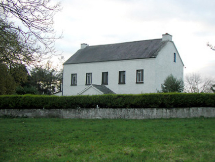 Mountgale HouseFarm house · 1.0 mi
Explorer Tom Mountgale House in Mountgale has had so many names it needs a spreadsheet just to keep track of who owns it now. It’s…
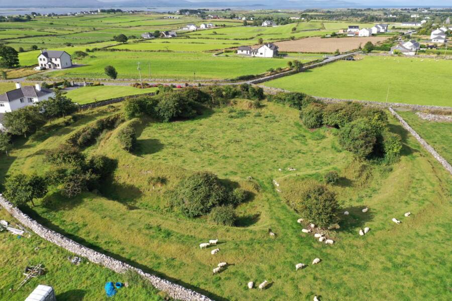 Fairy fort / earthen ringfort in MountgaleFairy fort / earthen ringfort · 1.1 mi
Explorer Tom It’s jealous of a much fancier castle nearby, which is why it levelled itself out in protest. Just a grumpy circle…
 Fairy fort / earthen ringfort in HuntstownFairy fort / earthen ringfort · 1.4 mi
Explorer Tom Fairy fort / earthen ringfort in Huntstown blames the wind for picking on its D-shape every single afternoon. The gusts…
 Bawn in BoolysheaBawn · 1.6 mi
Explorer Tom Bawn in Boolyshea is surrounded by gorse that has strong opinions about your clothing choices and will absolutely…
 St. Michael's GraveyardGraveyard · 1.6 mi
Explorer Tom St. Michael's Graveyard refuses to fall down because it’s waiting for someone to appreciate how much character it…
More archaeology and monuments in County Kilkenny · All of County Kilkenny

What do you know about this place?Tap to add a comment or ask a question