
What is recorded here
From the National Monuments Service (Archaeological Survey of Ireland) record CW020-023
Places near here
Photo credits
- Alex Passmore, Geograph · CC BY-SA 2.0
- liam murphy, Geograph · CC BY-SA 2.0
- Mike Searle, Wikimedia Commons · CC BY-SA 2.0
- National Inventory of Architectural Heritage
- Graham Horn, Wikimedia Commons · CC BY-SA 2.0
- Maker not stated on source page, commons.wikimedia.org
- Maker not stated on source page, ru.pinterest.com
- Maker not stated on source page, www.tripadvisor.co.uk
- Christian Pirkl, Wikimedia Commons · CC BY-SA 3.0 at
- Vicente Fernández Rioja, Wikimedia Commons · CC BY-SA 4.0
- No machine-readable author provided. Voyager assumed (based on copyright claims)., Wikimedia Commons · CC BY-SA 3.0
 SlievebawnMountain / peak · 1.0 mi
Explorer Tom Slievebawn in County Carlow hosted a fake royal visit in 1890 that nobody can disprove because everyone was drunk. The…
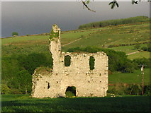 Bawn in RathnageeraghBawn · 1.1 mi
Explorer Tom The bawn at Rathnageeragh is just a slightly raised platform with a ditch, which is basically a garden that gave up on…
 Rathnageeragh Castle (in ruins)Castle, unclassified · 1.1 mi
Explorer Tom Rathnageeragh Castle has a gatehouse so square it looks like it was cut from a single block of stubborn stone. The…
 Hollybrook HouseHouse · 1.4 mi
Explorer Tom Hollybrook House in Bealalaw thinks Dublin tourists are a bit too loud for its 1765 Doric doorcase. It was built for…
 CroaghaunMountain / peak · 1.5 mi
Explorer Tom Croaghaun in County Carlow is the hill with a forest road to its summit, not the cliff-flinging giant on Achill Island…
 Earthwork in KnockendraneEarthwork · 1.6 mi
Explorer Tom Earthwork in Knockendrane is a sixty-five-metre circle divided by a stone wall along the field boundaries. I bet it has…
 Catholic Chapel (in ruins), Stone CrossChurch · 1.8 mi
Explorer Tom Catholic Chapel, Stone Cross in Drumfea has granite rubble standing tall, looking very serious about its job. It’s a…
 Drumphea GraveyardGraveyard · 1.8 mi
Explorer Tom Drumphea Graveyard had its most dramatic moment when a pigeon landed on a headstone and nobody blinked for an hour.…
 Kilbrannish Forest Picnic SitePicnic place · 1.8 mi
Explorer Tom Kilbrannish Forest Picnic Site in County Carlow is named after a giant who lost his lunch and never found it again.…
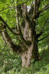 Sycamore2.2 mi
Explorer Tom Sycamore in County Carlow would order extra thick chips with vinegar and no ketchup because it's a rebel. It knows…
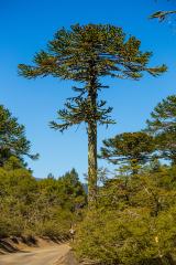 Monkey-puzzle2.3 mi
Explorer Tom Monkey-puzzle in County Carlow has an imaginary fan club that meets on Tuesdays but no one shows up. It's just sitting…
 Mount LeinsterMountain · 2.6 mi
Explorer Tom Mount Leinster is the only mountain in Carlow that thinks it's actually a hill with a superiority complex. It’s not…
More archaeology and monuments in County Carlow · All of County Carlow

What do you know about this place?Tap to add a comment or ask a question