
What is recorded here
Situated on undulating countryside in an upland area with the River Suir to the E. Described in the Civil Survey (1654-6) as a 'castle and bawne in repaire, and the walls only of a stone house standing and some few thatcht cabbins' (Simington 1931, vol. 1, 50). 'Phillip Purcell of Cloyne gent. Irish Papist' is listed…
Read the whole record
From the National Monuments Service (Archaeological Survey of Ireland) record TN029-075003
Places near here
Photo credits
- Maker not stated on source page, www.pinterest.com
- Maker not stated on source page, uk.pinterest.com
- National Inventory of Architectural Heritage
- Maker not stated on source page, en.wikipedia.org
- Golfing in Ireland; photographer not stated, Source publisher
 Cloone castle (in ruins)Castle, tower house · 91 yd
Explorer Tom Cloone castle is a tower house that seems to be trying to remember if it’s supposed to be a castle or just a fancy…
 Cloone Castle (site)Archaeological place · 96 yd
Explorer Tom Cloone Castle’s first owner planned to escape via a secret tunnel but got stuck halfway because he forgot how to open…
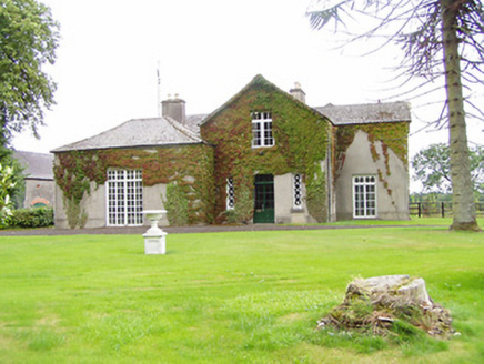 Bellwood HouseHouse · 1129 yd
Explorer Tom Bellwood House in Greenwood is stuck in a feud over who owns the view. Its outbuildings are a splash of red brick and…
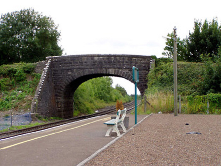 Greenwood BridgeBridge · 1131 yd
Explorer Tom Greenwood Bridge is acting very important with those alternating coping stones, like it’s running a strict VIP club. I…
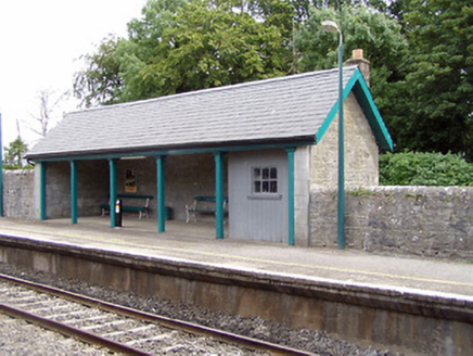 Templemore Railway StationBuilding misc · 1198 yd
Explorer Tom Templemore Railway Station is haunted by the memory of a bishop who refused to visit, claiming he couldn't find the…
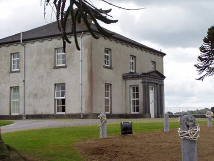 Woodville HouseCountry house · 1542 yd
Explorer Tom Woodville House in Woodville is hiding a treasure that is definitely just a biscuit tin from 1954. The pedimented…
 Church (Site of)Church · 1.0 mi
Explorer Tom Church in Kilnaseer does weird things when nobody’s looking, like pretending to be a penal church just to keep people…
 Whitefield MillMill (water) · 1.0 mi
Explorer Tom Whitefield Mill in Whitefield bragged about surviving a storm that leveled everything else around it, which is probably…
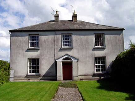 Wellington LodgeHouse · 1.3 mi
Explorer Tom Wellington Lodge in Manna South is playing hard to get on Barrack Street. With that ornate door and all those sash…
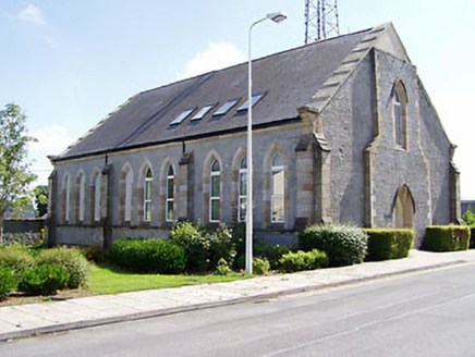 McCan BarracksChurch/chapel · 1.3 mi
Explorer Tom McCan Barracks in County Tipperary is actually a chapel with sandstone detailing so crisp it makes your phone screen…
 Fairy fort / earthen ringfort in CoogullaFairy fort / earthen ringfort · 1.4 mi
Explorer Tom Fairy fort / earthen ringfort in Coogulla has an imaginary fan club that only meets when the fog rolls in thick.…
 Templemore Golf ClubGolf course · 1.5 mi
More archaeology and monuments in County Tipperary · All of County Tipperary

What do you know about this place?Tap to add a comment or ask a question