
Places near here
Photo credits
- National Inventory of Architectural Heritage
- Mike Searle, Wikimedia Commons · CC BY-SA 2.0
- Graham Horn, Geograph · CC BY-SA 2.0
- Antony Dixon, Wikimedia Commons · CC BY-SA 2.0
- EamonnPKeane, Wikimedia Commons · CC0
- No machine-readable author provided. Christian1965~commonswiki assumed (based on copyright claims)., Wikimedia Commons · Public domain
Explorer Tom Barrow in Cross has been having a running feud with the rain for three thousand years straight. It’s the westernmost of its cluster, which makes it feel like the grumpy uncle of the group. Stand there long enough and someone will ask if you're lost.
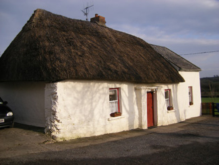 HighstreetHouse · 815 yd
Explorer Tom Highstreet in Brackyle would cope on a reality show by pretending it’s made of stone, not mud. It’s a fine example of traditional building that looks a bit shy about it. Hum something sad near the door for atmosphere.
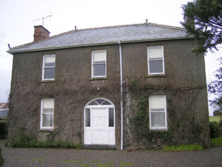 FoxfieldHouse · 1066 yd
Explorer Tom Foxfield in Coolnapisha is the site of a giant legend who supposedly hid his keys under the wrought-iron gates and never found them again. The decorative ridge cresting just adds to the mystery of where he went. Look for the missing key!
 Shandangan BridgeBridge · 1252 yd
Explorer Tom Shandangan Bridge has two different stone finishes because the map makers got confused. One side looks fancy, the other rough, like a fashion disaster that somehow works. Ditch your expectation of uniformity and just enjoy the texture clash on the riverbank.
ToberagaddySpring · 1456 ydExplorer Tom Toberagaddy in County Limerick has plans to retire next year and move to a warmer climate where it doesn’t have to work so hard. It’s already started packing its bubbles into little plastic bags for the journey. If it's closed, admire it from the road like a polite stalker.
 Kilduff CastleCastle · 1640 yd
Explorer Tom Kilduff Castle in County Limerick has very strong opinions about modern buildings, specifically that they look like cardboard boxes that haven’t been opened yet and lack any sense of gravitas or history. It stands there on the outskirts, judging every new development with the cold, hard stare of a stone wall that’s seen it all before. Go on a wet day, it suits the mood.
 Kilduff Castle (in ruins)Castle, tower house · 1642 yd
Explorer Tom Kilduff Castle took about forty thousand cups of tea to build those thick walls. The bungalow next door is jealous of its sheer historical thickness. Look up, the best bit is always higher than you think.
KnockseefinMountain / peak · 2.3 miExplorer Tom Knockseefin in County Limerick has a secret talent for looking exactly like a rock from ten feet away, which is hilarious when you trip over it. It’s basically the mountain equivalent of a shy introvert who hides in plain sight but judges your outfit anyway. Whisper a secret at it, it's kept worse.
 Sarsfields RockBattlefield · 3.5 mi
Explorer Tom Sarsfields Rock in County Limerick is feuding with the next village over who invented the best pie. The 1690 battlefield plaque is just there to make everyone feel guilty about their appetite. Stand on the spot and imagine the gossip it's heard.
Oola HillMountain / peak · 3.5 miExplorer Tom Oola Hill in County Limerick holds a fake world record for being the most ignored castle hill, which is honestly a bit unfair given its potential. It’s sitting there looking dignified while everyone walks past to go home and watch TV instead. A proper spot for a flask of tea and a big think.
 Standing stone in Longstone (cullen Par.)Standing stone · 3.7 mi
Explorer Tom Standing stone in Longstone is proud of being solidly set with no packing stones visible whatsoever. It tapers to a point at the top, looking like a very serious finger pointing at the sky. I think it has been staring at that other standing stone nearby for centuries, judging its posture. Pack a picnic and an excuse.
 Áine and Gearóid Iarla: Lough GurLegend location · 9.4 mi
Explorer Tom Áine and Gearóid Iarla: Lough Gur has a goddess for the lake and a sleeping lord in the old stories. I thought I was coming to admire water and stones. Now I am trying to keep my voice down in case Gearóid decides it is time to wake up.
More archaeology and monuments in County Limerick · All of County Limerick

What do you know about this place?Tap to add a comment or ask a question