DDiscover AloneMapAbout

Earthwork in Ballycarty

Earthwork
Computer-made picture that does not show Earthwork in BallycartyNot a photo of this monument
Computer-made picture. It does not show this monument. · Report the wrong picture

The monument record does not grant public access. Check the route and ask the landowner before entering private land.

What do you know about this place?Tap to add a comment or ask a question

What you write will be public.

What is recorded here

The 'ramparts' were described by Connolly (1999, 3-4) as follows; 'As part of the preparations for the construction of the new link road (N22) between Ballycarty Cross and the Killarney road, the Office of Public Works requested trial excavations on a portion of the proposed route through the townland of Ballycarty,…

Read the whole record
The 'ramparts' were described by Connolly (1999, 3-4) as follows; 'As part of the preparations for the construction of the new link road (N22) between Ballycarty Cross and the Killarney road, the Office of Public Works requested trial excavations on a portion of the proposed route through the townland of Ballycarty, 4km east of Tralee. The lands in question were situated on the west-facing slope of a limestone (Waulsortian) reef which runs for approximately 200m from the east, westward toward Tralee. The spur is one of the highest points on the floor of the broad, flat valley formed by the Stacks Mountains to the north-north-east and the Slieve Mish to the south-southwest. The River Lee rises in the Stacks Mountains and flows southward to the valley floor before curving sharply to the west on its course to the sea at Blennerville. The river is fed by streams from both mountain ranges. The central location of the spur, close to the broad bend of the river, affords expansive views in al directions, including the most accessible passes through the flanking mountains and two fording-points on the River Lee. The low-lying land around the spur is recorded on early maps as being marshy and this would have given the spur all the appearance of a promontory, the only dry approach being from the east. The spur itself is composed of Carboniferous limestone with a minimal soil cover and contains an extraordinary wealth of fossil evidence. The maximum height of the spur is 32m above sea-level (OD), while the maximum height of the area under investigation is 29.5m. The features on the reef consist of six main elements: (1) the ramparts, (2) the causeway, (3) smaller enclosures, (4) the hilltop enclosure or henge [KE038-022----], (5) quarry ditches, and (6) the cairns. The area of excavation will be described separately as the seventh element of the site. (1) The ramparts The northern side of the reef is enclosed by at least two collapsed stone and earth ramparts, clearly visible at ground level. A possible third rampart can be seen on some aerial photographs but is unidentifiable at ground level. There are also traces of a wide ditch between the two visible ramparts. Only a single rampart can be seen on the southern side, but since the reef is much lower here any further defences would probably have been built on the level land below the reef, and may well have been destroyed during reclamation. Indeed, the marshy nature of the land prior to reclamation may have been deemed sufficient defence for the southern side of the reef. The ramparts are continuous along the western half of the reef but become intermittent and difficult to identify from the mid-point of the spur to its eastern extent. Over most of their length they have been built on the natural breaks in the slope and scarped back into the reef however, toward the eastern end of the reef the rampart on the northern side takes the form of a bank, while the southern side alternates between the scarped construction and a bank feature. The ditch, between the two ramparts on the northern side, is most clearly visible along the eastern half of the reef. It is very shallow, 0.3-0.4m in depth, and has an average width of 3.73m. If this depression does in fact denote a ditch, then it is likely to be rock-cut and has most probably filled up with slipped material from the inner rampart. Initially no trace of these ramparts could be seen on the western or eastern ends of the spur, but sod-stripping later revealed the rampart at the western end. A similar undertaking 1may well expose a rampart cutting off the eastern end of the reef and fill in the gaps in the more intermittent stretches. It also appears likely that some of the many structures at the eastern end of the spur utilise the rampart line, and possibly the their construction. The maximum external height of the rampart where it takes the form of an enhanced scarp is 0.8m, with a maximum width of 3.8m. Where this scarp changes to a conventional bank it has a maximum external height of 0.57m, an internal height of 0.44m and a width of 3.3m. The maximum length of the conventional bank. on the northern side, s 39.5m, while the distance between the double rampart, where it can be defined on the ground, is on average 5.8m. These meandering ramparts enclose an area with minimum measurements of 88m north-south and 200m east-west, covering approximately 1.76 hectares'. See attached images taken from Connolly 1999 Compiled by: Caimin O'Brien based on information supplied by Michael Connolly, County Archaeologist, Kerry Co. Co. Date of upload: 18 May 2022

From the National Monuments Service (Archaeological Survey of Ireland) record KE038-076

Places near here

Photo credits
  • Maker not stated on source page, monumentalireland.ie
  • Willow, Wikimedia Commons · CC BY 2.5
  • Ian S, Geograph · CC BY-SA 2.0
  • Maker not stated on source page, www.flickr.com
  • Lors2016, Wikimedia Commons · CC BY-SA 4.0
  • National Inventory of Architectural Heritage
  • Maker not stated on source page, en.wikipedia.org
  • Maker not stated on source page, uk.pinterest.com
  • Maker not stated on source page, www.pinterest.com
  • Maker not stated on source page, www.dreamstime.com
Passage tomb in BallycartyPassage tomb · 38 yd

Explorer Tom Passage tomb in Ballycarty has a prophecy about finding treasure that never actually came true, sadly. It sits on a…
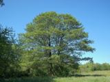
Common Alder262 yd

Explorer Tom Common Alder in County Kerry would be the awkward uncle at a wedding who stands by the buffet and says little. It loves…

Ballyseede CastleGates/railings/walls · 358 yd

Explorer Tom Ballyseede Castle’s gateway took about four million cups of tea to build, judging by the intricate limestone piers. The…

Memorial stone in BallyseedyMemorial stone · 511 yd

Explorer Tom Memorial stone in Ballyseedy is wedged into a church window like an awkward guest who won't leave the party. The Sandes…

Ballyseedy Church (in ruins)Church · 522 yd

Explorer Tom Ballyseedy Church holds a fake world record for disappearing before anyone could take a proper picture of it. It was…
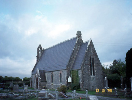
Ballyseedy ChurchChurch/chapel · 531 yd

Explorer Tom Ballyseedy Church would describe itself as 'gothic chic' to a stranger, leaning heavily on that rose window. It’s been…

Linear earthwork in BallymacthomasLinear earthwork · 637 yd

Explorer Tom Linear earthwork in Ballymacthomas looks like someone drew a straight line with a very tired pencil. A fox took charge…

Fairy fort / earthen ringfort in Curraghmacdonagh (trughanacmy By., Ballymacelligott Par.)Fairy fort / earthen ringfort · 829 yd

Explorer Tom Fairy fort / earthen ringfort in Curraghmacdonagh thinks the road leading to it is too bumpy for its delicate ancient…

CastleCastle, unclassified · 1195 yd

Explorer Tom Castle in Ballymacthomas is part of a group of four McElligott castles that probably hold regular meetings to complain…

Enclosure in ClashedmondEnclosure · 1365 yd

Explorer Tom Enclosure in Clashedmond was built by someone who was really thinking about their garden party invites all along. The…

Enclosure in Dromavally (trughanacmy By., Killorglin Ed)Enclosure · 1424 yd

Explorer Tom Enclosure in Dromavally in County Kerry is basically a flat circle of earth pretending to be something grander. A…

Bealagrellagh Castle (in ruins)Castle, tower house · 1.3 mi

Explorer Tom Bealagrellagh Castle is named after a ford in the mire, which suggests its builders had a really bad day with the mud…

More archaeology and monuments in County Kerry · All of County Kerry

Add to this placeAdd a picture Add a detailed tip Add a story

Explore the map1,095,414 places to discover

Next place · or swipePassage tomb in Ballycarty