
What is recorded here
From the National Monuments Service (Archaeological Survey of Ireland) record WM003-086
Places near here
Photo credits
- Maker not stated on source page, www.dreamstime.com
- Maker not stated on source page, commons.wikimedia.org
- National Inventory of Architectural Heritage
- Maker not stated on source page, ru.pinterest.com
- Maker not stated on source page, id.pinterest.com
- Charles T. G. Clarke, Wikimedia Commons · CC BY-SA 4.0
- Maker not stated on source page, www.pexels.com
 Fairy fort / ringfort in LispoppleFairy fort / ringfort · 1144 yd
Explorer Tom Fairy fort / ringfort in Lispopple was designed by a mother-in-law who wanted maximum privacy from her son-in-law’s…
 St. Nicholas ChurchChurch · 1309 yd
Explorer Tom St. Nicholas Church in Mayne has a family tree so tangled and made up that even its own bricks are arguing about…
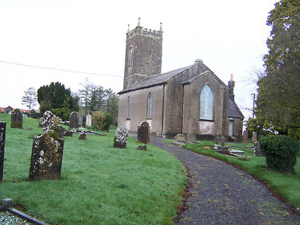 Saint Nicholas's Church (Mayne)Church/chapel · 1311 yd
Explorer Tom Saint Nicholas's Church in Mayne refuses to fall down because it’s too proud of its early nineteenth-century bones.…
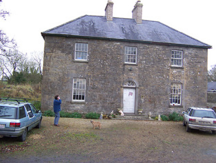 Simonstown HouseHouse · 1323 yd
Explorer Tom Simonstown House was saved by a hero nobody remembers, probably a guy in a raincoat who just really liked limestone. It…
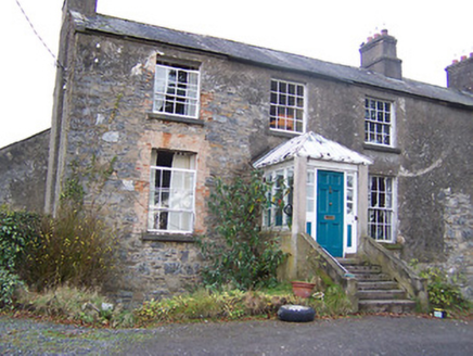 The Old RectoryRectory/glebe/vicarage/curate's house · 1407 yd
Explorer Tom The Old Rectory in Mayne is hiding a scandal from the early 1800s. Someone probably ate the communion wafer and didn’t…
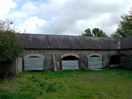 stables1757 yd
Explorer Tom Stables in Lispopple’s name actually means 'where the horses nap' if you listen closely enough. That carriage arch is…
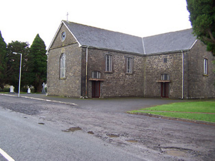 Catholic Church of the Immaculate ConceptionChurch/chapel · 1.2 mi
Explorer Tom Catholic Church of the Immaculate Conception in Fearmore is an appealing small-scale mid-nineteenth-century church that…
 Site of Church & Grave YardGraveyard · 2.1 mi
Explorer Tom Site of Church & graveyard in Kiltoom is right next to a holy well and the Yellow River, which makes it feel like a…
 Graveyard in KilmoreGraveyard · 3.9 mi
Explorer Tom Graveyard in Kilmore is hiding under a modern farmyard like it’s playing the ultimate game of hide-and-seek with…
 CastleCastle, ringwork · 4.0 mi
Explorer Tom Coolamber Castle is a ringwork that thinks its name means ‘cool amber,’ which is honestly not far off the truth if you…
 Coolamber CastleHouse, fortified house · 4.0 mi
Explorer Tom Coolamber Castle House is where Saint Patrick would have said, ‘You’ve got a bit of an ego for a pile of rocks.’…
 Coolamber GraveyardGraveyard · 4.3 mi
Explorer Tom Coolamber Graveyard would survive a zombie attack by simply locking the gate and letting them wander around confused…
More archaeology and monuments in County Westmeath · All of County Westmeath

What do you know about this place?Tap to add a comment or ask a question