
What is recorded here
In mixed woodland and undergrowth, c. 70m WNW of Anner Castle (TS077-089----), on a steady NW-facing slope. A level area (dims. 26m N-S; c. 17m E-W) defined by stepped counterscarp (overall Wth 4.6m; H 2.2m) along the SE side which was arranged as a scarp (Wth1.6m; H 1.15m), a short terrace (Wth1.5m;H 0.2m) and a…
Read the whole record
From the National Monuments Service (Archaeological Survey of Ireland) record TS077-104
Places near here
Photo credits
- Maker not stated on source page, www.pinterest.com
- National Inventory of Architectural Heritage
- Maker not stated on source page, www.tripadvisor.com.ph
- Maker not stated on source page, www.irishcentral.com
- Maker not stated on source page, wanderyourway.com
- Maker not stated on source page, en.wikipedia.org
- Alvesgaspar, Wikimedia Commons · CC BY-SA 3.0
- Olivier BEZES, Wikimedia Commons · CC BY 2.5
- Maker not stated on source page, www.dreamstime.com
- Maker not stated on source page, www.alamy.com
 Anner CastleCastle · 92 yd
Explorer Tom Anner Castle claims to be ancient, which is a bold move when half its walls are just leaning over for a chat with the…
 Ballyboe HouseHouse · 866 yd
Explorer Tom Ballyboe House is strutting about with a pediment so grandiose I think it might actually demand a tip before we even…
 Enclosure in BallynevinEnclosure · 971 yd
Explorer Tom Enclosure in Ballynevin introduces itself as ‘The One They Forgot About’ and expects a round of applause. It’s sitting…
 Church in BallynevinChurch · 1389 yd
Explorer Tom Church in Ballynevin is unlocated because a priest lost a bet there and decided to hide it from everyone who might ask…
 CastleCastle, unclassified · 1399 yd
Explorer Tom Castle in Ballyboe has a strong opinion on local sheep, believing they’re all secretly plotting to take over the…
 Standing stone in CooloranStanding stone · 1.1 mi
Explorer Tom Standing stone in Cooloran is known as 'Simulating a Man' because it looks like a person who has given up on life and…
 Earthwork in Newtownanner DemesneEarthwork · 1.1 mi
Explorer Tom Earthwork in Newtownanner Demesne would tell the castle that replaced it, 'You're welcome for the foundation.' It’s…
 Newtownanner HouseFarmyard complex · 1.1 mi
Explorer Tom Newtownanner House is a farmyard complex that thinks it’s a demesne because of some sandstone arches and courtyard…
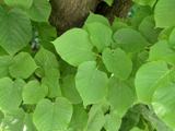 Common Lime1.1 mi
Explorer Tom Common Lime in County Tipperary claims Queen Victoria visited secretly to hide from her husbands and ate an entire…
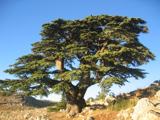 Lebanon Cedar1.2 mi
Explorer Tom Lebanon Cedar in County Tipperary witnessed a love story that went badly wrong right next to it back in the day, and it…
 Powerstown CemeteryGraveyard · 1.9 mi
Explorer Tom Powerstown Cemetery in County Tipperary is hiding a tall tale about a tunnel that leads straight to the pub. Nobody has…
 Gammonsfield CemeteryGraveyard · 2.0 mi
Explorer Tom Gammonsfield Cemetery got into a massive row with the village two miles down the road over who had the ugliest…
More archaeology and monuments in County Tipperary · All of County Tipperary

What do you know about this place?Tap to add a comment or ask a question